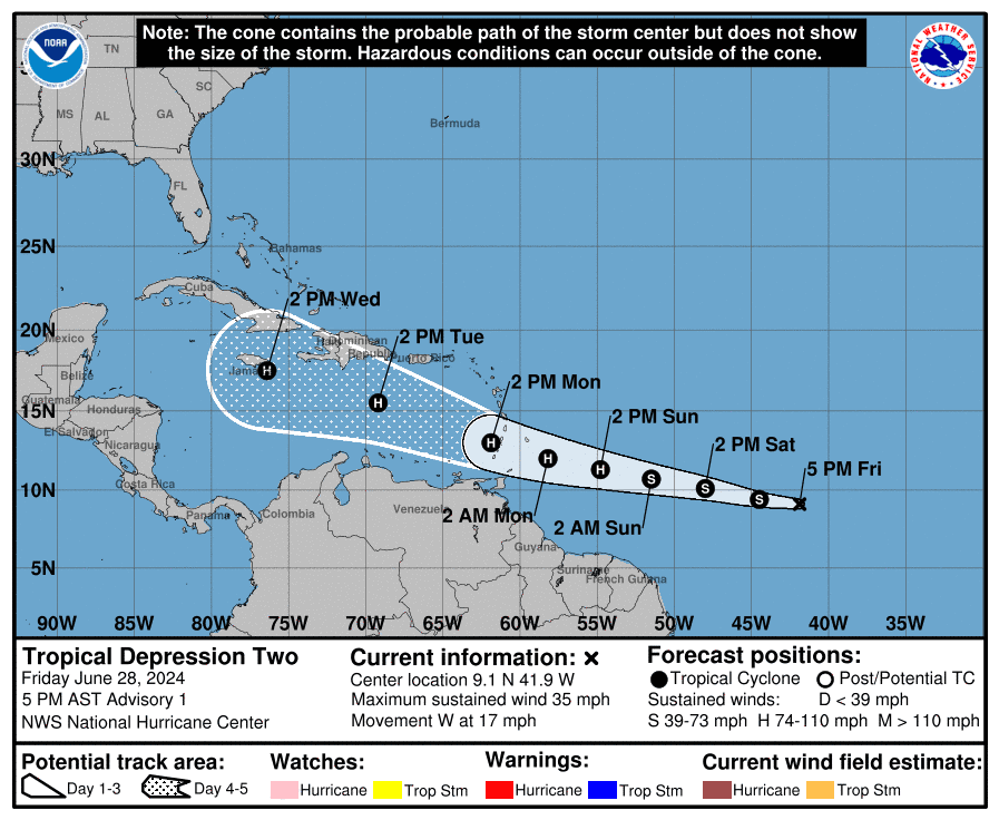
MIAMI, Florida – NOAA‘s National Hurricane Center issued a Public Advisory at 5 p.m. Eastern Daylight Time on Friday, June 28, 2024, due to the presence of Tropical Depression Two, which is forecast to strengthen into Hurricane Beryl over the Caribbean.
Tropical Depression 2 (formerly Invest 95L) is located 1225 miles east-southeast of Barbados and is moving to the west at 17 mph (28 km/h).
NHC forecasters say that a relatively quick westward to west-northwestward motion is expected during the next few days. On the forecast track, the system is expected to move across the Windward Islands late Sunday night and Monday.
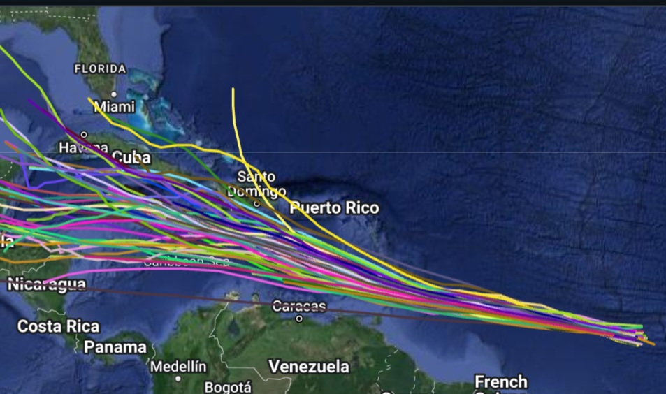
Computer models, often referred to as spaghetti models, are in general agreement that Tropical Depression 2 will move west-northwest towards the Lesser Antilles.
However, there is a fair amount of spread in the model guidance, especially in the day 3-5 time frame.
The official NHC track forecast lies near the consensus aids and is slightly south of the middle of the guidance envelope.
Tropical Depression 2 has maximum sustained winds of 35 mph (55 km/h), with higher gusts.
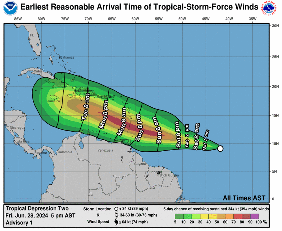
The official NHC forecast calls for strengthening and shows the depression becoming a tropical storm tonight or early Saturday and then a hurricane before it reaches the Windward Islands, then continue to strengthen into a Category 2 hurricane on the Saffir-Simpson Hurricane Wind Scale on Monday.
It should be noted that some of the model guidance is quite aggressive and a fair amount are higher than the official forecast. For example, the hurricane regional models show the system becoming a major hurricane and the GFS model shows the system deepening below 970 mb prior to reaching the Windward Islands.
NOAA and Colorado State University forecast an “extremely active” 2024 Atlantic Hurricane Season, which runs from June 1 through November 30.
Copyright 2023-2025 FloridaWord.com