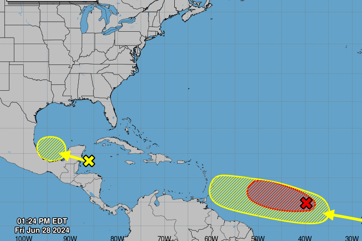
MIAMI, Florida – NOAA‘s National Hurricane Center in Miami, Florida, issued a Tropical Weather Outlook at 2 p.m. Eastern Daylight Time on Friday, June 28, 2024, due to the presence of a system that may form into a tropical cyclone within the next 7 days.
The system, dubbed Invest 95L, is a low pressure system located about 1400 miles east-southeast of the Windward Islands that is gradually becoming better defined (marked with a red “X”).
NHC forecasters say that showers and thunderstorms are also showing signs of organization, and a tropical depression will likely form later today or early Saturday.
Invest 95L is expected is expected to move westward at 15 to 20 mph and approach the Lesser Antilles by the end of the weekend. Hurricane or Tropical Storm Watches could be required for portions of that region tonight or early Saturday.
This system has a near 100% chance of tropical cyclone formation within the next 7 days and a near 100% chance within the next 48 hours.
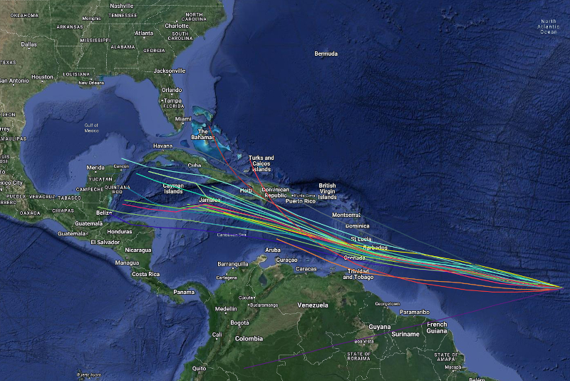
Spaghetti models are in general agreement that Invest 95L will move west towards the Lesser Antilles.
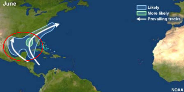
| NOAA Prevailing Atlantic Hurricane Tracks June |
If this system develops into a tropical storm or hurricane, the next name on the 2024 Atlantic Hurricane List is Beryl.
NOAA and Colorado State University forecast an ‘extremely active’ 2024 Atlantic Hurricane Season, which runs from June 1 through November 30.
RELATED:
Copyright 2023-2025 FloridaWord.com