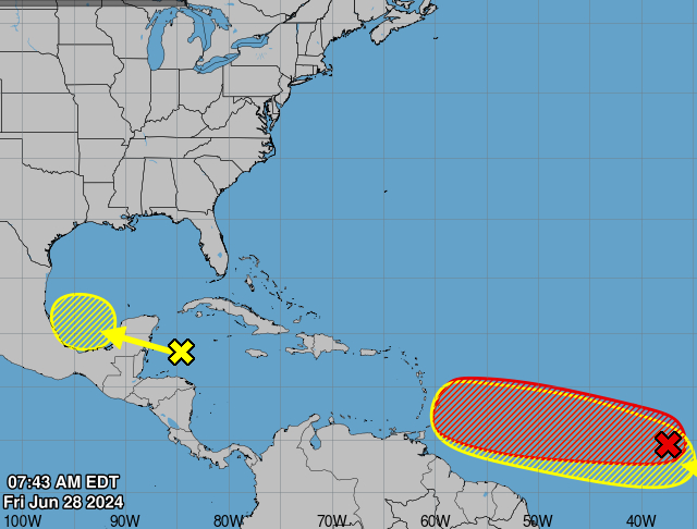
MIAMI, Florida – NOAA‘s National Hurricane Center in Miami, Florida, issued a Tropical Weather Outlook at 8 a.m. Eastern Daylight Time on Friday, June 28, 2024, due to the presence of a system that may form into a tropical cyclone within the next 7 days.
The system, dubbed Invest 94L, is a broad area of low pressure over the western Caribbean Sea associated with a tropical wave that continues to produce widespread shower and thunderstorm activity (marked with a yellow “X”).
NHC forecasters say that development of this system is not expected today while it moves west-northwestward at around 15 mph, and an Air Force reconnaissance mission planned for today has been canceled.
Invest 94L is then expected to move westward over the Yucatan Peninsula and emerge over the Bay of Campeche late Saturday or early Sunday, at which point some development will be possible.
Regardless of development, heavy rainfall associated with the tropical wave will affect portions of Central America and Mexico through the weekend.
This system has a 30% chance of tropical cyclone formation within the next 7 days and a 30% chance within the next 48 hours.
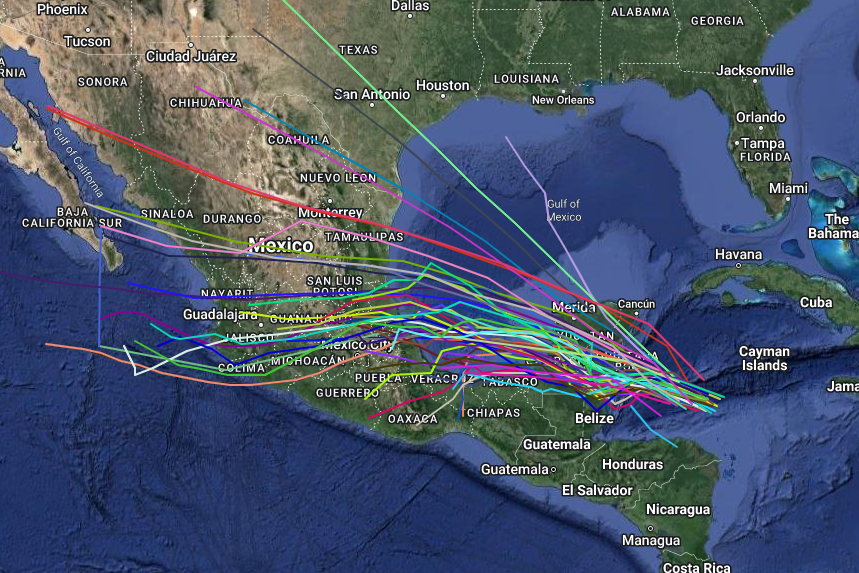
Spaghetti models are in general agreement that Invest 94L will move west-northwestward towards Belize, the southern Yucatan Peninsula, and the Bay of Campeche.
Latest computer model guidance continues to suggest high precipitation amounts through early next week.
| NOAA Prevailing Atlantic Hurricane Tracks June |
If this system develops into a tropical storm or hurricane, the next name on the 2024 Atlantic Hurricane List is Beryl.
NOAA and Colorado State University forecast an ‘extremely active’ 2024 Atlantic Hurricane Season, which runs from June 1 through November 30.
RELATED:
Copyright 2023-2025 FloridaWord.com