NOAA National Hurricane Center Tropical Weather Outlook for June 13, 2026.
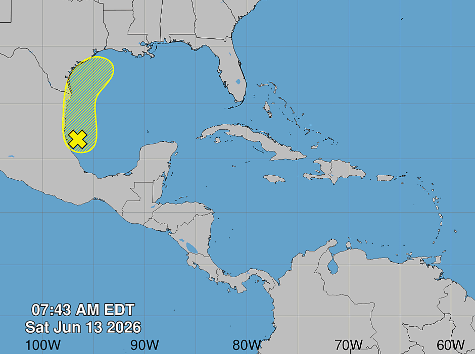
MIAMI, Florida – NOAA‘s National Hurricane Center in Miami, Florida, issued a Tropical Weather Outlook at 8:00 AM Eastern Daylight Time on Saturday, June 13, 2026, due to the presence of a system that may form into a tropical cyclone within the next 7 days just off the coast of Texas
If this system develops into a tropical storm or hurricane, the next name on the 2026 Atlantic Hurricane List is Arthur.
The system is a broad area of low pressure located just offshore of eastern Mexico that continues to produce some shower and thunderstorm activity.
NHC forecasters say that although this system has become better organized since yesterday, marginal environmental conditions will probably prevent significant development before the low moves inland over eastern Mexico by Sunday.
The system could re-emerge over the northwestern Gulf on Tuesday or Wednesday while interacting with a frontal boundary, but conditions there are also expected to be only marginally conducive for development.
This system has a 20% chance of tropical cyclone formation within the next 48 hours and a 20% chance within the next 7 days.
NOAA forecasts a “below-normal” 2026 Atlantic Hurricane Season, which runs from June 1 through November 30.
Although peak hurricane season isn’t until September 10, hurricane and tropical storm activity begins to pick up in late June, according to NOAA and the National Weather Service‘s historical hurricane activity data.
Copyright 2023-2025 FloridaWord.com

