NOAA National Hurricane Center Tropical Weather Outlook for June 27, 2026.
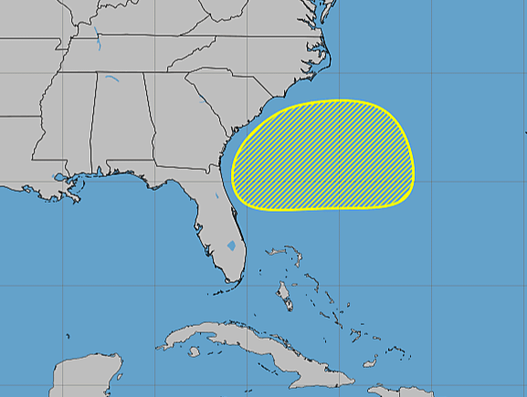
MIAMI, Florida – NOAA‘s National Hurricane Center in Miami, Florida, issued a Tropical Weather Outlook at 2 PM Eastern Daylight Time on Saturday, June 27, 2026, due to the presence of a disturbance that may form into a tropical cyclone within the next 7 days just off the southeastern coast of the United States.
If this system develops into a tropical storm or hurricane, the next name on the 2026 Atlantic Hurricane List is Bertha.
A low pressure area is expected to form offshore of the southeastern coast of the United States along the western end of a frontal system early next week. Slow development of this system will be possible thereafter while it moves slowly westward.
NHC forecasters say that the system is being monitored for gradual organization, though environmental conditions are expected to remain only marginally conducive for significant development in the near term.
This system has a near 0% chance of tropical cyclone formation within the next 48 hours and a 20% chance within the next 7 days.
NOAA forecasts a “below-normal” 2026 Atlantic Hurricane Season, which runs from June 1 through November 30.
Although peak hurricane season isn’t until September 10, hurricane and tropical storm activity begins to pick up in late June, according to NOAA and the National Weather Service‘s historical hurricane activity data.
Copyright 2023-2025 FloridaWord.com

