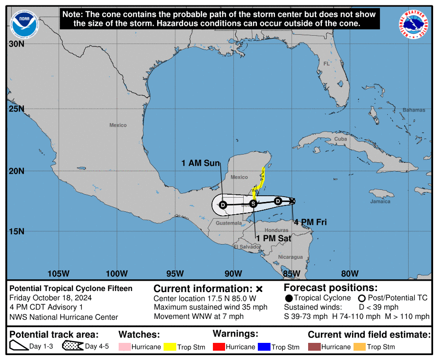
MIAMI, Florida – NOAA‘s National Hurricane Center issued a Public Advisory at 5 p.m. Eastern Daylight Time on Friday, October 18, 2024, due to the presence of Potential Tropical Cyclone 15, which is forecast to strengthen into a tropical depression before making landfall on Central America.
If this system develops into a tropical storm or hurricane, the next name on the 2024 Atlantic Hurricane List is Nadine.
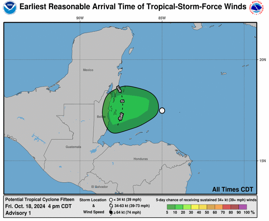
Potential Tropical Cyclone 15 (formerly Invest 95L) is located about Belize City and is moving to the west-northwest at 7 mph (11 km/h).
NHC forecasters say that Potential Tropical Cyclone 15 is expected to turn westward tonight before reaching land tomorrow.
Computer models, often referred to as spaghetti models, are in good agreement during the first 48 hours that the system will move in a general westerly direction before making landfall somewhere on Belize.
Potential Tropical Cyclone 15 has maximum sustained winds of 35 mph (55 km/h), with higher gusts.
Some slow strengthening is forecast, and the system could become a tropical cyclone before making landfall tomorrow.
A Tropical Storm Watch is in effect for Belize City to Tulum.
| NOAA and Colorado State University forecast an “extremely active” 2024 Atlantic Hurricane Season, which runs from June 1 through November 30.
Peak hurricane season was September 10, according to NOAA and the National Weather Service’s historical hurricane activity data. |
Copyright 2023-2025 FloridaWord.com