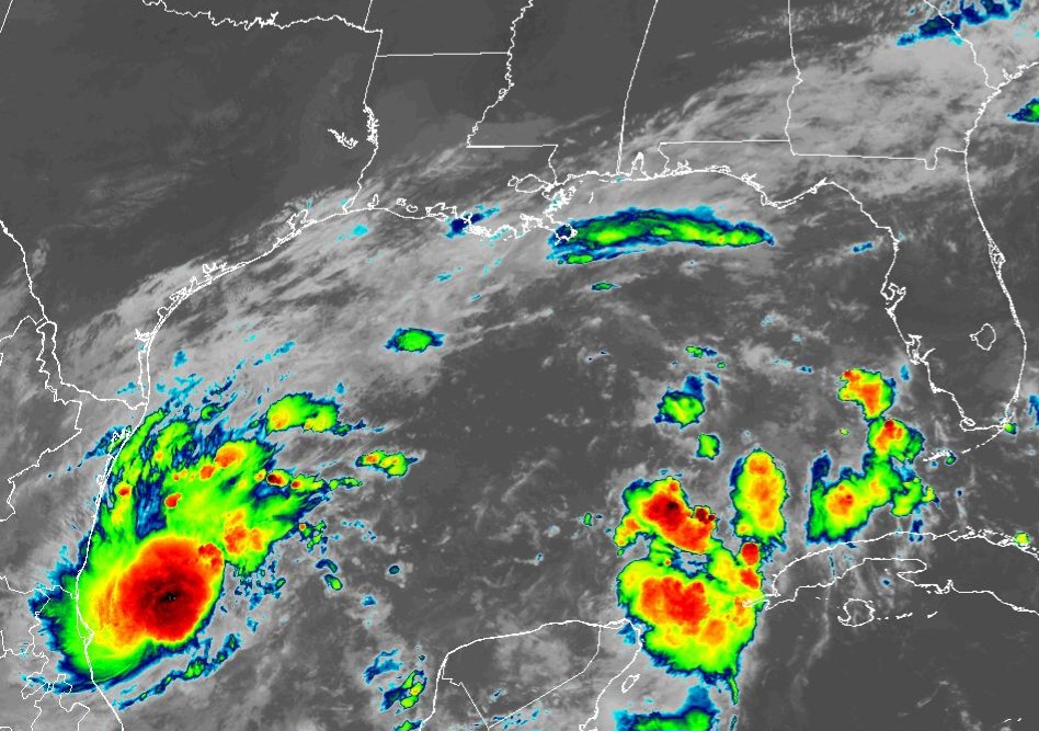
TAMPA, Florida – NOAA‘s National Hurricane Center in Miami, Florida, issued a Public Advisory at 11 a.m. Eastern Daylight Time on Saturday, October 5, 2024, due to the presence of Tropical Depression Fourteen over the Gulf of Mexico that is forecast to strengthen into Hurricane Milton before making landfall on the Gulf Coast of Florida.
Tropical Depression 14 (formerly Invest 92L) is located about 210 miles north-northeast of Vera Cruz, Mexico, and is moving to the north-northeast at 3 mph (6 km/h).
NHC forecasters say that a slow northeastward or east-northeastward motion is expected during the next day or so. A faster east-northeastward to northeastward motion is forecast by Monday and Tuesday.
On the official NHC forecast track, the depression is expected to remain over the southwestern Gulf of Mexico through Sunday night, then move across the south-central Gulf of Mexico on Monday and Tuesday, and approach the west coast of the Florida Peninsula by midweek.
Computer models, often referred to as spaghetti models, are in agreement during the first 48 hours that Tropical Depression 14 will move in a general eastward direction, then east-northeastward direction toward the Florida peninsula. Both the GFS (American model) and the ECMWF (European model) show a similar track.
The NHC track lies near the various consensus aids, but it slightly faster since the typically reliable GFS and ECMWF global models are on the faster side of the guidance.
Tropical Depression 14 has maximum sustained winds of 35 mph (55 km/h), with higher gusts.
Rapid strengthening is forecast during the next few days. The depression is forecast to become a tropical storm later today and a hurricane by early Monday.
The system could become a major Category 3 hurricane on the Saffir-Simpson Hurricane Wind Scale while it moves across the central and eastern Gulf of Mexico.
If this system develops into a tropical storm or hurricane, the next name on the 2024 Atlantic Hurricane List is Milton.
NOAA and Colorado State University forecast an “extremely active” 2024 Atlantic Hurricane Season, which runs from June 1 through November 30.
| NOAA historical hurricane data. Peak season and storm frequency. |
Peak hurricane season is September 10, according to NOAA and the National Weather Service’s historical hurricane activity data.
Copyright 2023-2025 FloridaWord.com


