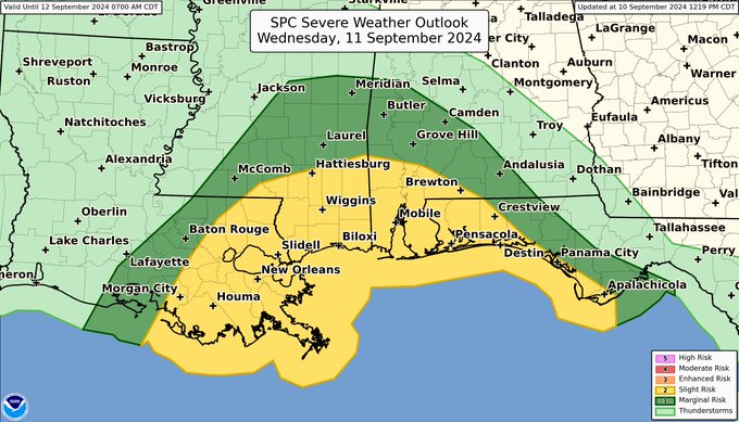
| In addition to the threat for hurricane-force winds, flooding, and storm surge with Tropical Cyclone Francine, a few tornadoes will also be possible across the central Gulf Coast on Wednesday. This graphic shows where the greatest tornado threat is currently forecast. Credit: NWS Storm Prediction Center |
PENSACOLA, Florida- The National Oceanic and Atmospheric Administration (NOAA) and the National Weather Service (NWS) have issued advisories for parts of northwest Florida due to Tropical Storm Francine.
As of September 10, 2024, the storm is moving north-northeastward across the western Gulf of Mexico.
Tropical Storm Francine, with sustained winds of 65 mph, is currently located approximately 640 miles southwest of Pensacola,Florida. The storm is expected to strengthen into a hurricane later today or tonight before making landfall in Louisiana on Wednesday.
A Tropical Storm Watch has been issued for portions of the western Florida panhandle, including Escambia, Santa Rosa, and Okaloosa Counties. Residents should prepare for possible impacts, including strong winds, heavy rainfall, and flooding in coastal areas.
Copyright 2023-2025 FloridaWord.com