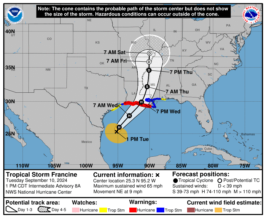
HOUSTON, Texas – NOAA‘s National Hurricane Center issued a Public Advisory at 2 p.m. Eastern Daylight Time on Tuesday, September 10, 2024, due to the presence of Tropical Storm Francine, which is forecast to strengthen into Hurricane Francine later today.
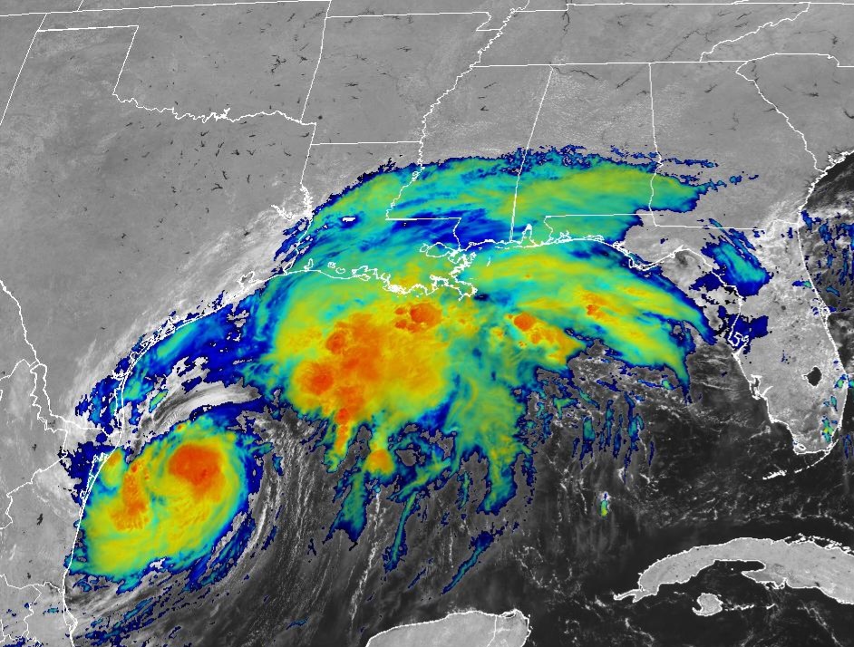
Tropical Storm Francine (formerly Invest 91L and Potential Tropical Cyclone 6) is located about 380 miles southwest of Morgan City, Louisiana, and is moving to the northeast at 9 mph (14 km/h).
NHC forecasters say that a continued northeastward motion and a faster forward speed are expected later this afternoon and tonight.
On the official NHC forecast track, Francine is anticipated to move away from the coast of northeastern Mexico and south Texas this afternoon, move across the northwestern Gulf of Mexico tonight, and then make landfall in Louisiana on Wednesday.
After landfall, the center is expected to move into Mississippi on Wednesday night or Thursday.
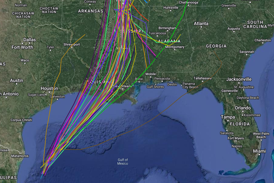
Computer models, often referred to as spaghetti models, are in good agreement during the first 24 hours that the system will move in a general north-northeastward then northeastward direction.
After 24 hours, there is more divergence in the track models, but both the GFS (American model) and the ECMWF (European model) show a similar northeast track toward the Louisiana coast.
There has been an eastward shift of the guidance since the last advisory, and thus the new official NHC forecast track is also shifted eastward.
Tropical Storm Francine has maximum sustained winds of 65 mph (100 km/h), with higher gusts.
Tropical-storm-force winds extend outward up to 140 miles (220 km).
Significant strengthening is expected, and Francine is forecast to become a Category 1 hurricane on the Saffir-Simpson Hurricane Wind Scale later today, and a Category 2 hurricane before making landfall.
A Storm Surge Warning is currently in effect for areas from High Island, Texas, to the Mississippi/Alabama border, including Vermilion Bay, Lake Maurepas, and Lake Pontchartrain.
A Hurricane Warning has been issued for the Louisiana coast, extending from Sabine Pass to Grand Isle.
A Storm Surge Watch is in effect from the Mississippi/Alabama border to the Alabama/Florida border, including Mobile Bay.
A Tropical Storm Warning covers the Texas coast from High Island to Sabine Pass, the area east of Grand Isle, Louisiana, to the Mississippi/Alabama border, including metropolitan New Orleans, Lake Pontchartrain, and Lake Maurepas.
Additionally, a Tropical Storm Watch is in effect for the Texas coast from Matagorda to High Island and the Alabama coast from the Mississippi/Alabama border to the Alabama/Florida border.
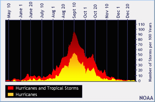
NOAA and Colorado State University forecast an “extremely active” 2024 Atlantic Hurricane Season, which runs from June 1 through November 30.
| NOAA historical hurricane data. Peak season and storm frequency. |
Peak hurricane season is September 10, according to NOAA and the National Weather Service‘s historical hurricane activity data.
Copyright 2023-2025 FloridaWord.com