
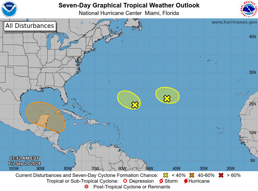
MIAMI, Florida – NOAA‘s National Hurricane Center in Miami, Florida, issued a Tropical Weather Outlook at 8 a.m. Eastern Daylight Time on Friday, September 20, 2024, due to the presence of a system that may form into tropical cyclone within the next 7 days over the northwestern Caribbean Sea and Gulf of Mexico.
The system (marked with an orange “X”) is a broad area of low pressure that could form by the early to middle part of next week over the northwestern Caribbean Sea.
NHC forecasters say that gradual development of this system is possible, and a tropical depression could form as the system moves slowly to the north or northwest over the northwestern Caribbean Sea and into the southern Gulf of Mexico through the end of next week.
This system has a 40% chance of tropical cyclone formation within the next 7 days and a near 0% chance within the next 48 hours.
If this system develops into a tropical storm or hurricane, the next name on the 2024 Atlantic Hurricane List is Helene.
NOAA and Colorado State University forecast an “extremely active” 2024 Atlantic Hurricane Season, which runs from June 1 through November 30.
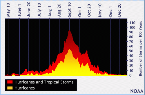 |
| NOAA historical hurricane data. Peak season and storm frequency. |
Peak hurricane season is September 10, according to NOAA and the National Weather Service‘s historical hurricane activity data.