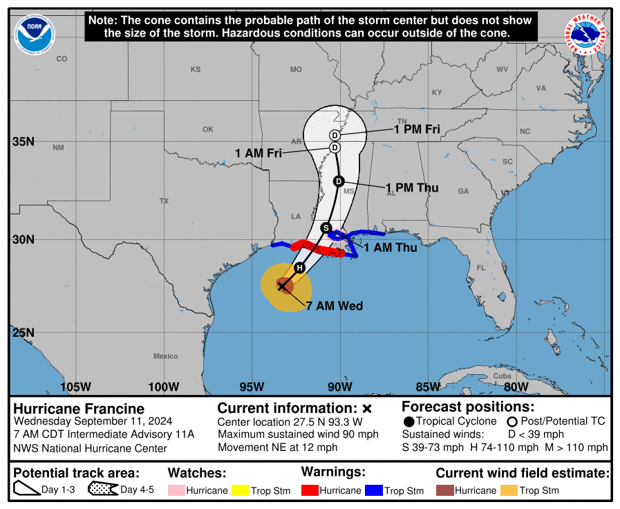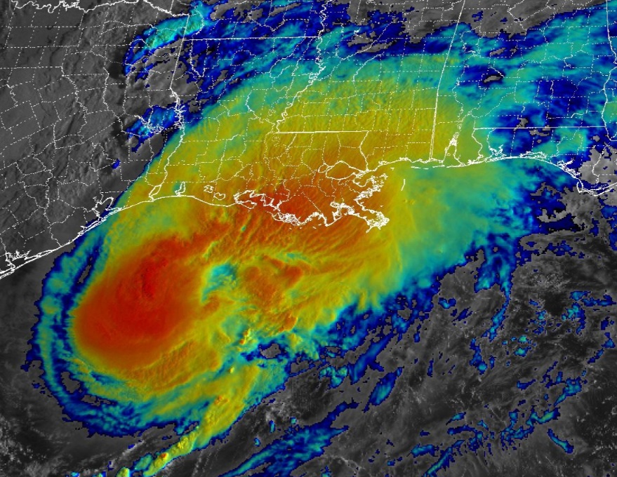
NEW ORLEANS, Louisiana – NOAA‘s National Hurricane Center issued a Public Advisory at 8 a.m. Eastern Daylight Time on Wednesday, September 11, 2024, due to the presence of Hurricane Francine that is expected to make landfall on the Louisiana coast later today.
Hurricane Francine (formerly Invest 91L and Potential Tropical Cyclone 6) is located about 195 miles southwest of Morgan City, Louisiana, and is moving to the northeast at 12 mph (19 km/h).
NHC forecasters say that a faster northeastward motion is expected today, and Francine is anticipated to make landfall in Louisiana within the warning area this afternoon or evening.
After landfall, the center is expected to move northward across Mississippi on Thursday and Thursday night.
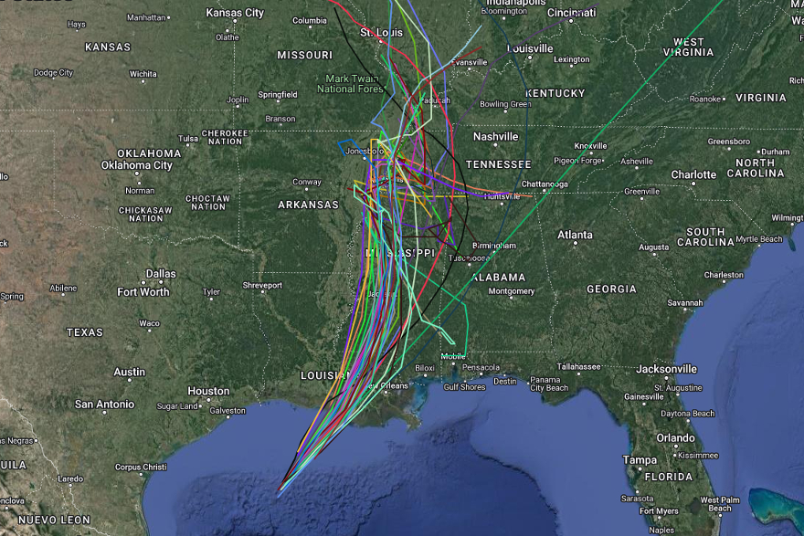
Computer models, often referred to as spaghetti models, are in strong agreement during the first 24 hours that the system will move in a general northeastward direction.
The track guidance is fairly tightly clustered, and the latest NHC forecast lies near the center of the guidance envelope of both the GFS (American model) and the ECMWF (European model) and very close to the consensus aids.
Hurricane Francine has maximum sustained winds of 90 mph (150 km/h), with higher gusts.
Hurricane-force winds extend outward up to 40 miles (65 km) from the center and tropical-storm-force winds extend outward up to 115 miles (185 km).
Some strengthening is expected, and Francine is forecast to become a Category 2 hurricane on the Saffir-Simpson Hurricane Wind Scale when it makes landfall.
A Storm Surge Warning is currently in effect for areas from Cameron, Louisiana, to the Mississippi/Alabama border, including Vermilion Bay, Lake Maurepas, and Lake Pontchartrain.
A Hurricane Warning has been issued for the Louisiana coast from Vermilion/Cameron Line eastward to Grand Isle.
A Storm Surge Watch is currently in effect from the Mississippi/Alabama border to the Alabama/Florida border, including Mobile Bay.
A Hurricane Watch has been issued for Lake Maurepas, Lake Pontchartrain, and the New Orleans metropolitan area.
A Tropical Storm Warning is in effect for the Louisiana coast, stretching eastward from Sabine Pass to the Vermilion/Cameron Line, as well as east of Grand Isle, Louisiana, to the Alabama/Florida border, including Lake Maurepas, Lake Pontchartrain, and the New Orleans metropolitan area.
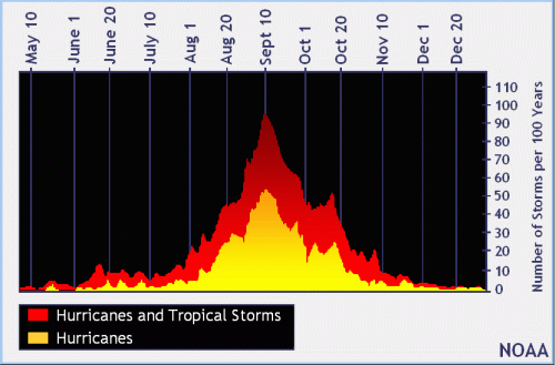
NOAA and Colorado State University forecast an “extremely active” 2024 Atlantic Hurricane Season, which runs from June 1 through November 30.
| NOAA historical hurricane data. Peak season and storm frequency. |
Peak hurricane season is September 10, according to NOAA and the National Weather Service’s historical hurricane activity data.
Copyright 2023-2025 FloridaWord.com