TAMPA, Florida – NOAA‘s National Hurricane Center issued a Public Advisory Update at 2:25 p.m. Eastern Daylight Time on Thursday, September 26, 2024, due to the presence of Hurricane Helene, which is forecast to strengthen into a Category 4 hurricane before making landfall on the Gulf Coast of Florida.
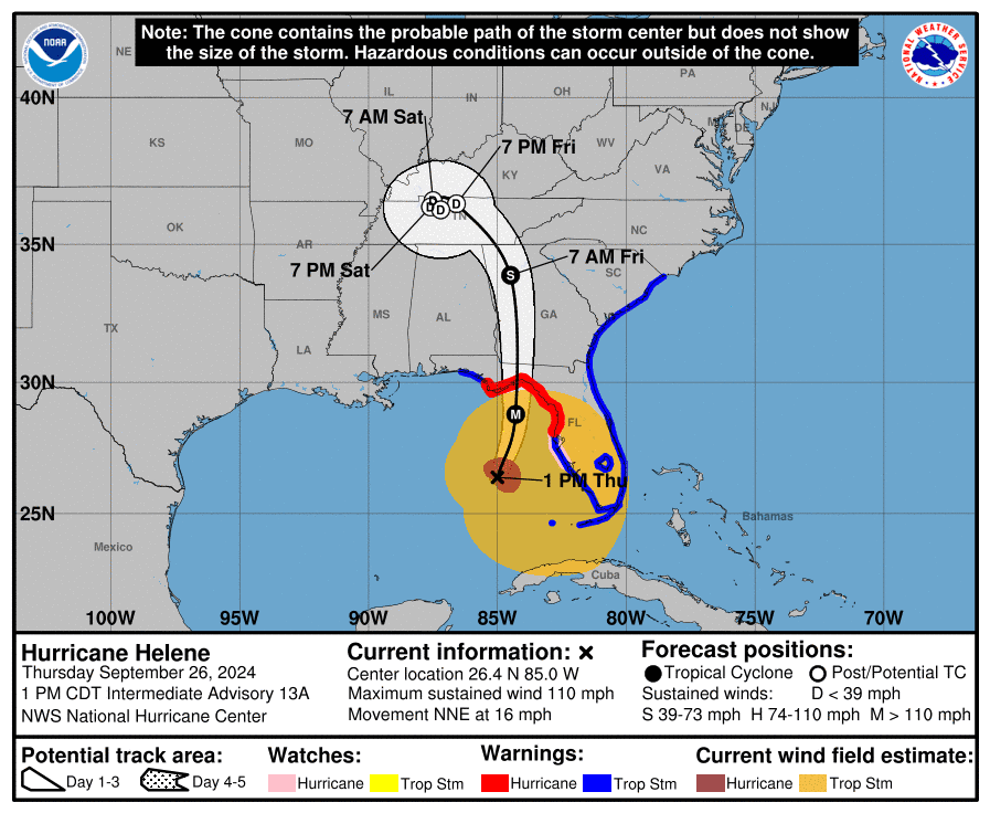
Hurricane Helene (formerly Invest 97L and Potential Tropical Cyclone 9) is located about 170 miles southwest of Tampa, Florida, and is moving to the north-northeast at 16 mph (26 km/h).
NHC forecasters say that a significant increase in forward speed is expected during the next 24 hours.
On the official NHC forecast track, Helene will make landfall in the Florida Big Bend region this evening.
After landfall, Helene is expected to turn northwestward and slow down over the Tennessee Valley on Friday and Saturday.
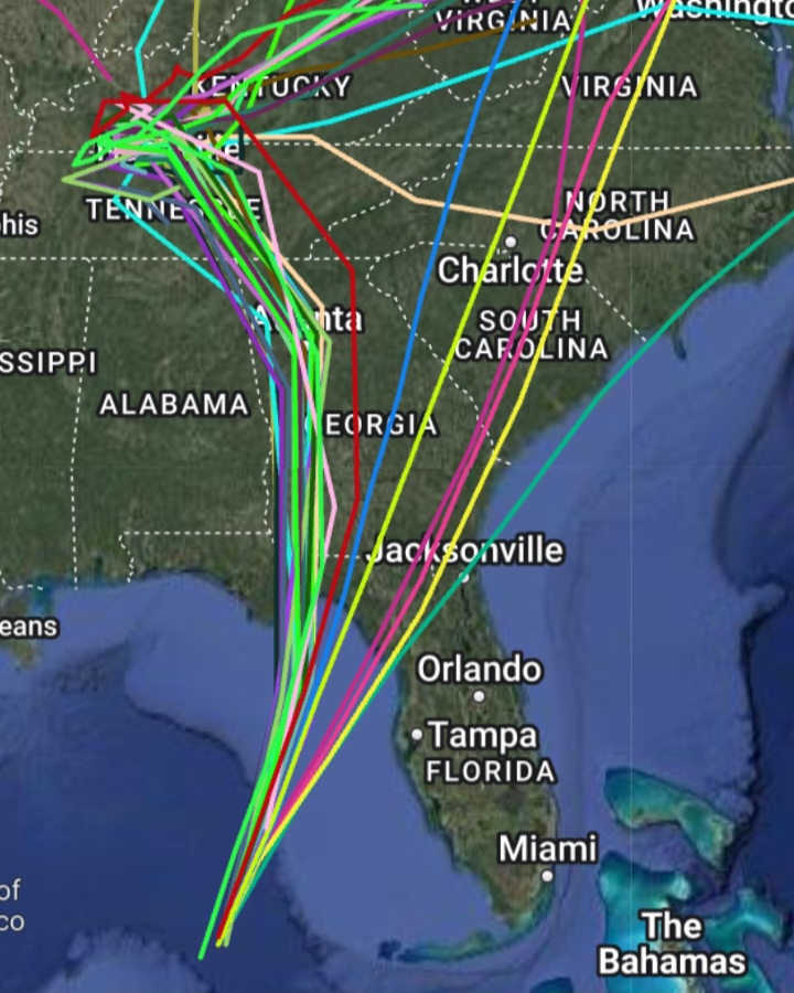
Computer models, often referred to as spaghetti models, are in agreement during the first 24 hours that Helene will move to the north-northeast through Thursday. Both the GFS (American model) and the ECMWF (European model) show a similar track.
The official track forecast through landfall is very similar to the previous NHC prediction and remains close to the corrected consensus guidance.
Hurricane Helene has maximum sustained winds near 120 mph (195 km/h), with higher gusts.
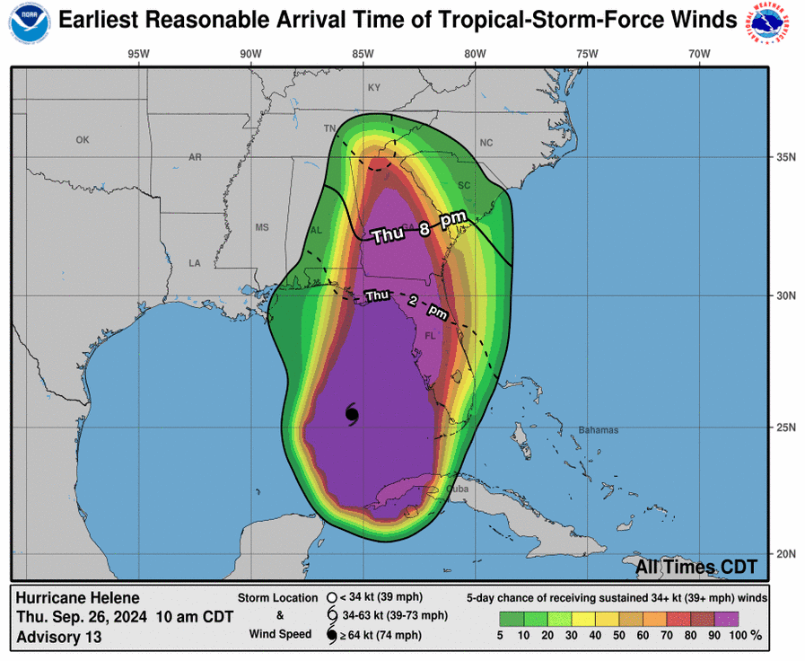
Hurricane-force winds extend outward up to 60 miles (95 km) from the center of the tropical cyclone, and tropical-storm-force winds extend outward up to 345 miles (555 km).
Strengthening is expected during the next few days, and the system is forecast to become a Category 4 hurricane on the Saffir-Simpson Hurricane Wind Scale on Thursday as it moves across the eastern Gulf of Mexico.
A Storm Surge Warning is currently in effect for the area from Indian Pass southward to Flamingo, including Tampa Bay and Charlotte Harbor.
A Hurricane Warning has been issued from Anclote River to Mexico Beach, Florida.
A Hurricane Watch is in place from Englewood to Anclote River, including Tampa Bay.
A Tropical Storm Warning is active for Florida the Keys, including the Dry Tortugas, Flamingo to Anclote River, including Tampa Bay, west of Mexico Beach to the Okaloosa/Walton County Line, Flamingo northward to South Santee River, and Lake Okeechobee.
NOAA and Colorado State University forecast an “extremely active” 2024 Atlantic Hurricane Season, which runs from June 1 through November 30.
| NOAA historical hurricane data. Peak season and storm frequency. |
Peak hurricane season is September 10, according to NOAA and the National Weather Service’s historical hurricane activity data.
Copyright 2023-2025 FloridaWord.com