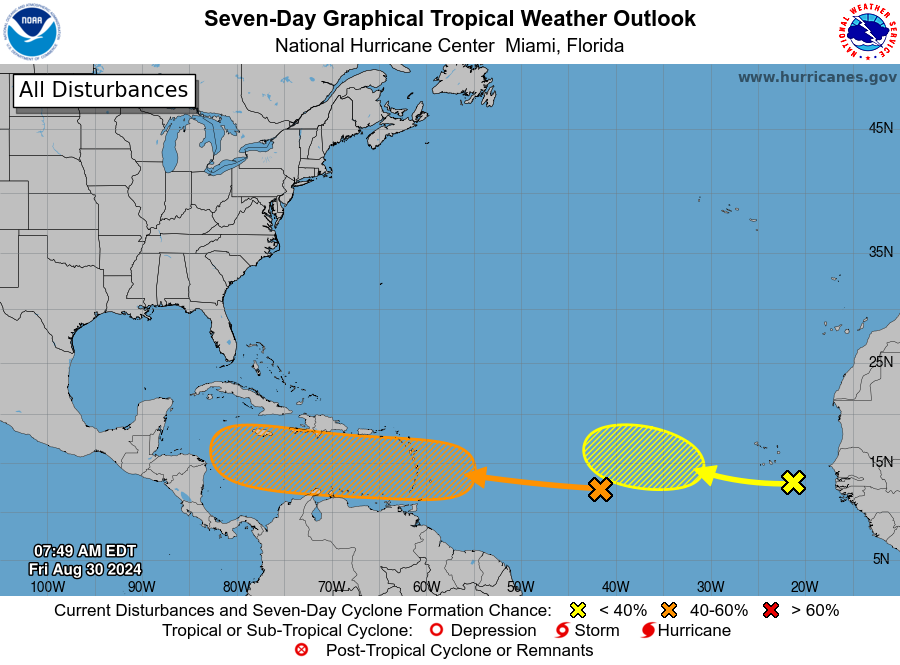
MIAMI, Florida – NOAA‘s National Hurricane Center in Miami, Florida, issued a Tropical Weather Outlook at 8 a.m. Eastern Daylight Time on Friday, August 30, 2024, due to the presence of a system that may form into tropical cyclone within the next 7 days over the eastern Caribbean.
The system (marked with an orange “X”) is a tropical wave located over the central Tropical Atlantic Ocean that is producing some disorganized showers and thunderstorms.
NHC forecasters say that environmental conditions appear conducive for gradual development of this system, and a tropical depression could form some time next week while it moves westward, reaching the Lesser Antilles on Monday and continuing across the Caribbean Sea through the middle to latter part of the week
This system has a 40% chance of tropical cyclone formation within the next 7 days and a near 0% chance within the next 48 hours.
If this system develops into a tropical storm or hurricane, the next name on the 2024 Atlantic Hurricane List is Francine.
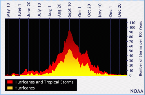
NOAA and Colorado State University forecast an “extremely active” 2024 Atlantic Hurricane Season, which runs from June 1 through November 30.
| NOAA historical hurricane data. Peak season and storm frequency. |
Although peak hurricane season isn’t until September 10, the end of August is when tropical storm and hurricane activity begins to pick up, according to NOAA and the National Weather Service‘s historical hurricane activity data.
Copyright 2023-2025 FloridaWord.com