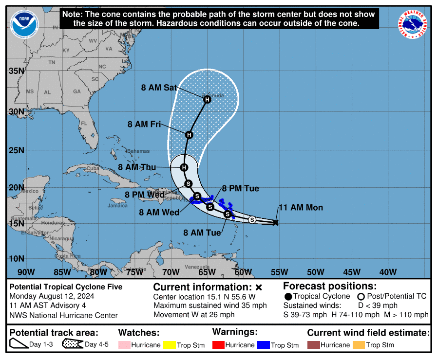
MIAMI, Florida – NOAA‘s National Hurricane Center issued a Public Advisory at 11 a.m. Eastern Daylight Time on Monday, August 12, 2024, due to the presence of Potential Tropical Cyclone 5, which may form into a tropical cyclone within the next 7 days over the Caribbean and then stay well off of the Florida east coast.
Potential Tropical Cyclone 5 (formerly Invest 98L) is located about 730 miles east-southeast of San Juan, Puerto Rico, and is moving to the west at 26 mph (43 km/h).
NHC forecasters say that this motion is expected to continue with some decrease in forward speed during the next couple of days.
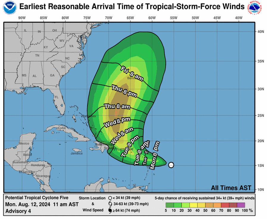
On the official NHC forecast track, the disturbance is expected to move across portions of the Leeward Islands late tonight or Tuesday and approach the U.S. and British Virgin Islands and Puerto Rico Tuesday evening. Then, the disturbance is forecast to move away from Puerto Rico over the western Atlantic through midweek.
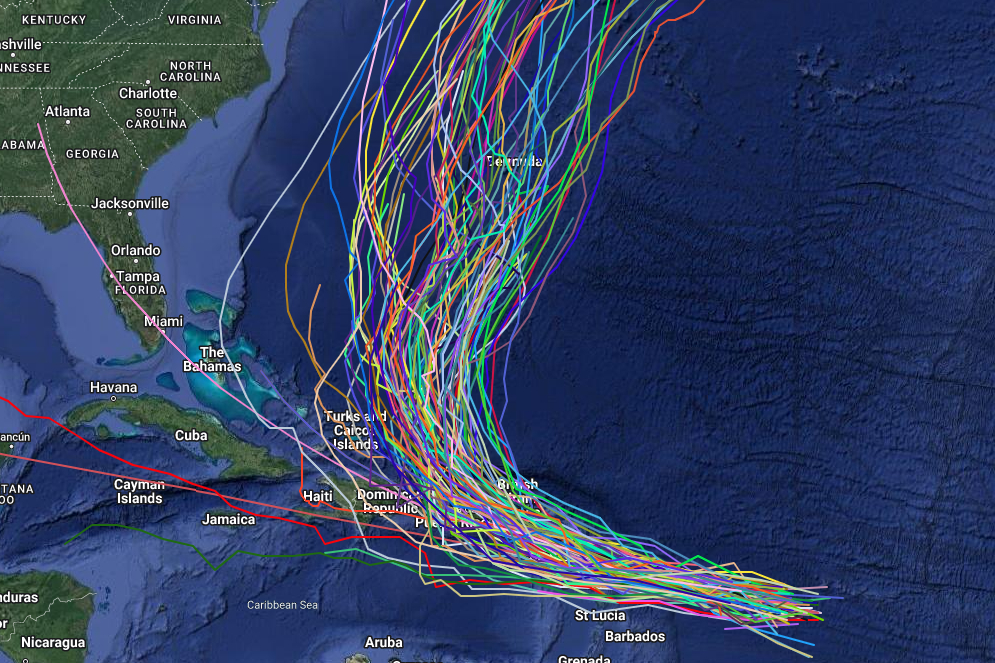
Computer models, often referred to as spaghetti models, are in general agreement that Potential Tropical Cyclone 5 will move west-northwest towards the Greater Antilles.
However, there is a large spread between the models after the system moves near or over Puerto Rico and the Dominican Republic with most models showing a turn back out over the open Atlantic toward Bermuda, while a few other models bring Potential Tropical Cyclone 5 towards the Turks and Caicos Islands before turning north.
The NHC track guidance envelope has shifted to the left of the previous track, which is likely due to the faster forward speed and the weaker initial state of the system.
The NHC track forecast is based on a blend of the latest GFS (American model), ECMWF (European model), and consensus models.
Potential Tropical Cyclone 5 has maximum sustained winds of 35 mph (55 km/h), with higher gusts.
Some strengthening is forecast, and the system is expected to become a tropical storm by later today and a Category 1 hurricane on the Saffir-Simpson Hurricane Wind Scale by Thursday.
If this system develops into a tropical storm or hurricane, the next name on the 2024 Atlantic Hurricane List is Ernesto.
A Tropical Storm Warning is in effect for: St. Kitts, Nevis, Montserrat, Antigua, Barbuda, Anguilla, Guadeloupe, St. Martin, St. Barthelemy, Sint Maarten, British Virgin Islands, U.S. Virgin Islands, Puerto Rico, Vieques, Culebra.
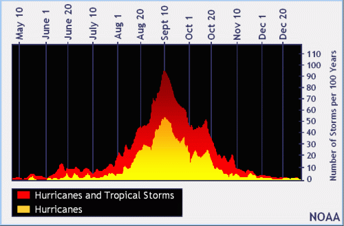
| NOAA historical hurricane data. Peak season and storm frequency. |
Although peak hurricane season isn’t until September 10, the beginning of August is when tropical storm and hurricane activity begins to pick up, according to NOAA and the National Weather Service‘s historical hurricane activity data.
NOAA and Colorado State University forecast an “extremely active” 2024 Atlantic Hurricane Season, which runs from June 1 through November 30.
Copyright 2023-2025 FloridaWord.com