UPDATE: Potential Tropical Cyclone 4 Track To Florida
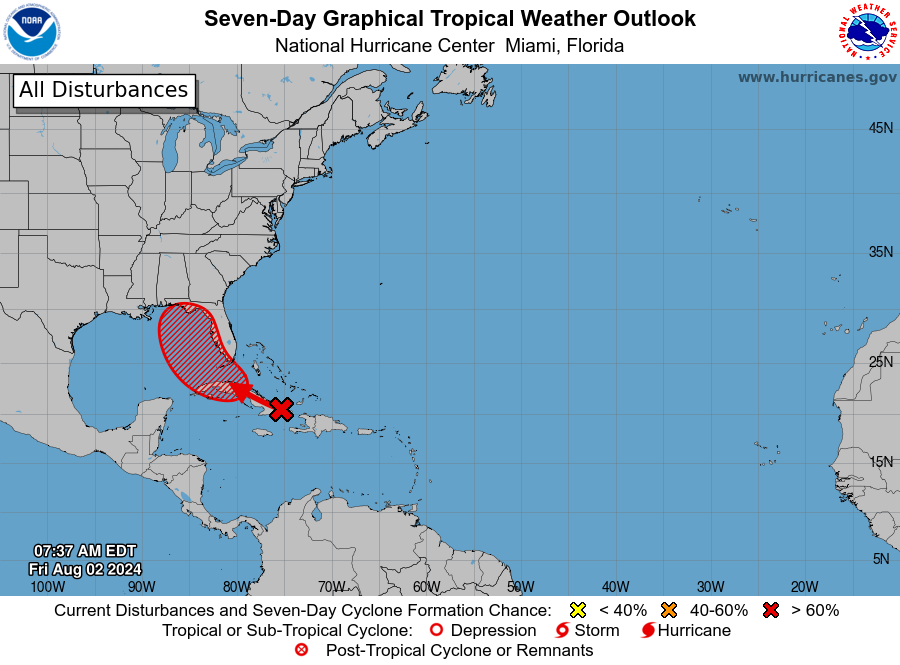
MIAMI, Florida – NOAA‘s National Hurricane Center in Miami, Florida, issued a Tropical Weather Outlook at 8 a.m. Eastern Daylight Time on Friday, August 2, 2024, due to the presence of Invest 97L, that may form into a tropical cyclone within the next 7 days over the Caribbean and then head to Florida.
The system (marked with a red “X”) is a well-defined tropical wave that is producing a large area of disorganized showers and thunderstorms over Hispaniola, the southeastern Bahamas, eastern Cuba, and the adjacent waters of the southwestern Atlantic.
Invest 97L is expected to move west-northwestward near or over Cuba on Friday and then emerge over the Straits of Florida tonight or Saturday.
NHC forecasters say that environmental conditions are expected to be conducive for additional development after that time, and a tropical depression is likely to form this weekend over the Straits of Florida or eastern Gulf of Mexico near the Florida Peninsula.
Invest 97L has a 90% chance of tropical cyclone formation within the next 7 days and a 60% chance within the next 48 hours.
Regardless of development, heavy rains could cause areas of flash flooding across Florida, Cuba, and the Bahamas through the weekend. Interests in these locations should continue to monitor the progress of this system.
A NOAA Hurricane Hunter aircraft is scheduled to investigate this system today, if necessary.
“Florida is monitoring Invest 97L in the Atlantic, which is expected to strengthen and potentially make landfall as early as this weekend,” said Florida Governor Ron DeSantis who declared a State of Emergency.
“It will be slow-moving and bring lots of rain that could cause significant flooding.”
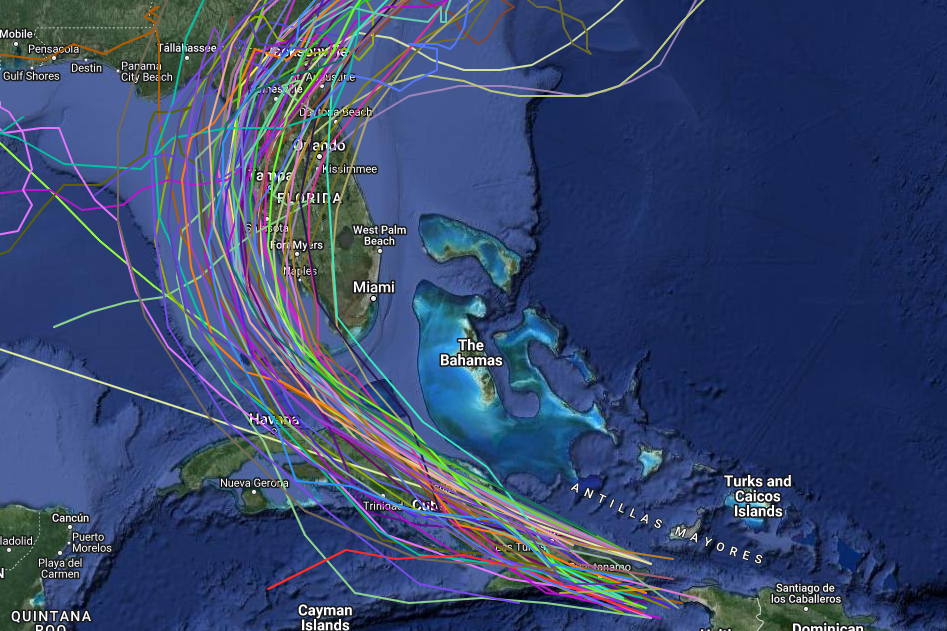
Computer models, often referred to as spaghetti models, are in general agreement that Invest 97L will move west-northwest towards and over Cuba, then hook to the north over the Gulf of Mexico and move parallel to the west coast of the Florida peninsula before making landfall somewhere between Fort Myers and Cedar Key, with the greatest consensus for landfall around Tampa.
If this system develops into a tropical storm or hurricane, the next name on the 2024 Atlantic Hurricane List is Debby.
NOAA and Colorado State University forecast an “extremely active” 2024 Atlantic Hurricane Season, which runs from June 1 through November 30.
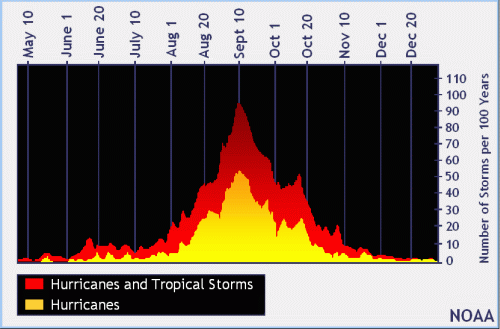
| NOAA historical hurricane data. Peak season and storm frequency. |
Although peak hurricane season isn’t until September 10, the end of July is when tropical storm and hurricane activity begins to pick up, according to NOAA and the National Weather Service‘s historical hurricane activity data.
Copyright 2023-2025 FloridaWord.com