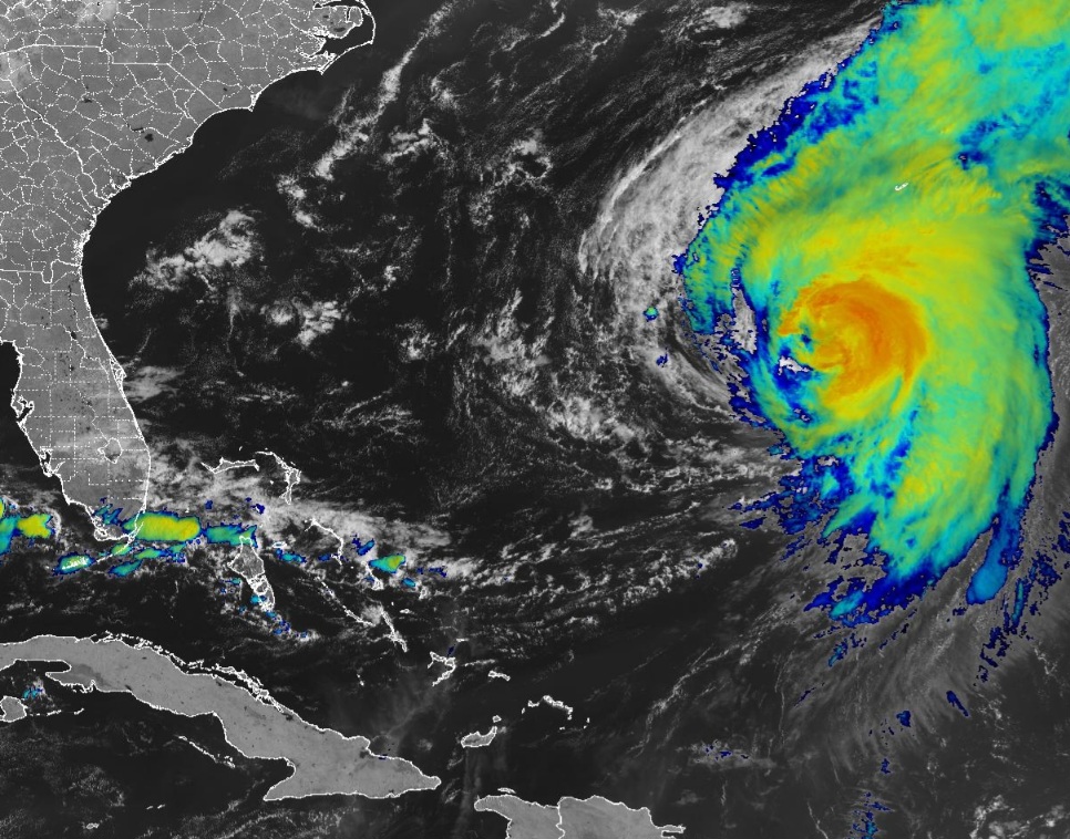
MIAMI, Florida – NOAA‘s National Hurricane Center issued a Public Advisory at 11 a.m. Eastern Daylight Time on Friday, August 16, 2024, due to the presence of Category 2 Hurricane Ernesto far off Florida’s east coast.
Swells generated by Ernesto are expected to reach the east coast of the United States today and continue into the weekend.
Hurricane Ernesto (formerly Invest 98L and Potential Tropical Cyclone 5) is located about 215 miles south-southwest of Bermuda, and is moving to the north-northeast at 14 mph (22 km/h).
NHC forecasters say that this general motion is expected to continue with a gradual slowdown by Saturday. A faster northeastward motion is expected late in the weekend.
On the official NHC forecast track, the center of Ernesto is expected to pass near or over Bermuda on Saturday morning.
Computer models, often referred to as spaghetti models, are in good agreement during the first 24 hours. After 24 hours, there is more divergence in the track models, with the GFS (American model) on the eastern edge of the envelope while the ECMWF (European model) shows less turning and is on the western edge of the envelope.
There have been little changes to the most recent NHC track forecast, which lies just west of the corrected consensus aid, HCCA.
Hurricane Ernesto has maximum sustained winds of 100 mph (155 km/h), with higher gusts.
Hurricane-force winds extend outward up to 76 miles (120 km) from the center of the cyclone and tropical-storm-force winds extend outward up to 275 miles (445 km).
Ernesto is a Category 2 hurricane on the Saffir-Simpson Hurricane Wind Scale.
A Hurricane Warning is in effect for Bermuda.
| NOAA historical hurricane data. Peak season and storm frequency. |
Although peak hurricane season isn’t until September 10, the beginning of August is when tropical storm and hurricane activity begins to pick up, according to NOAA and the National Weather Service‘s historical hurricane activity data.
NOAA and Colorado State University forecast an “extremely active” 2024 Atlantic Hurricane Season, which runs from June 1 through November 30.
Copyright 2023-2025 FloridaWord.com