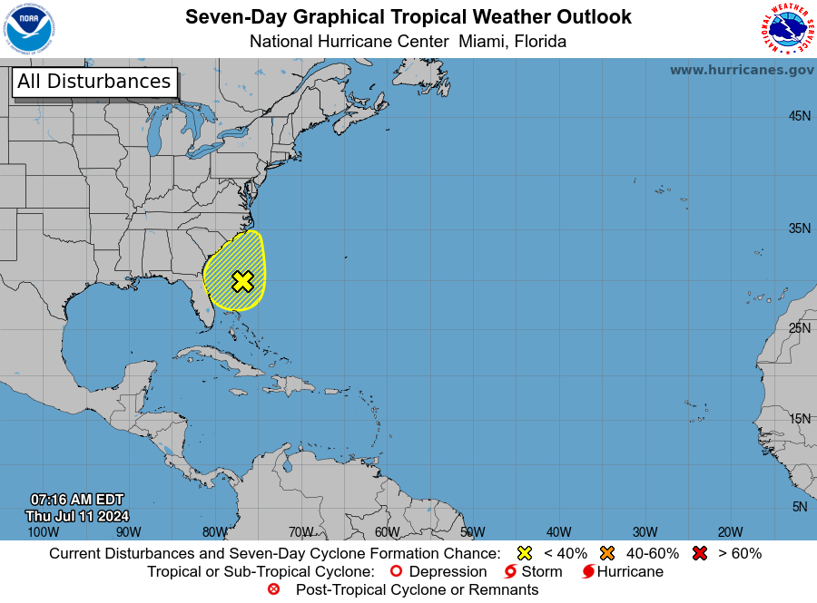
MIAMI, Florida – NOAA‘s National Hurricane Center in Miami, Florida, issued a Tropical Weather Outlook at 8 a.m. Eastern Daylight Time on Thursday, July 11, 2024, due to the presence of a system that may form into a tropical cyclone within the next 7 days off the east coast of Florida.
The system (marked with a yellow “X”) is a broad trough of low pressure located off the southeastern U.S. coast that is currently producing some disorganized showers and thunderstorms.
NHC forecasters say that environmental conditions do not appear favorable for much additional development of this system over the next day or two before it moves inland over the southeastern U.S. by this weekend.
Regardless of development, heavy rainfall will be possible for portions of the Carolina coast late this week into the weekend.
This system has a 10% chance of tropical cyclone formation within the next 7 days and a 10% chance within the next 48 hours.
If this system develops into a tropical storm or hurricane, the next name on the 2024 Atlantic Hurricane List is Chris.
NOAA and Colorado State University forecast an “extremely active” 2024 Atlantic Hurricane Season, which runs from June 1 through November 30.
Copyright 2023-2025 FloridaWord.com