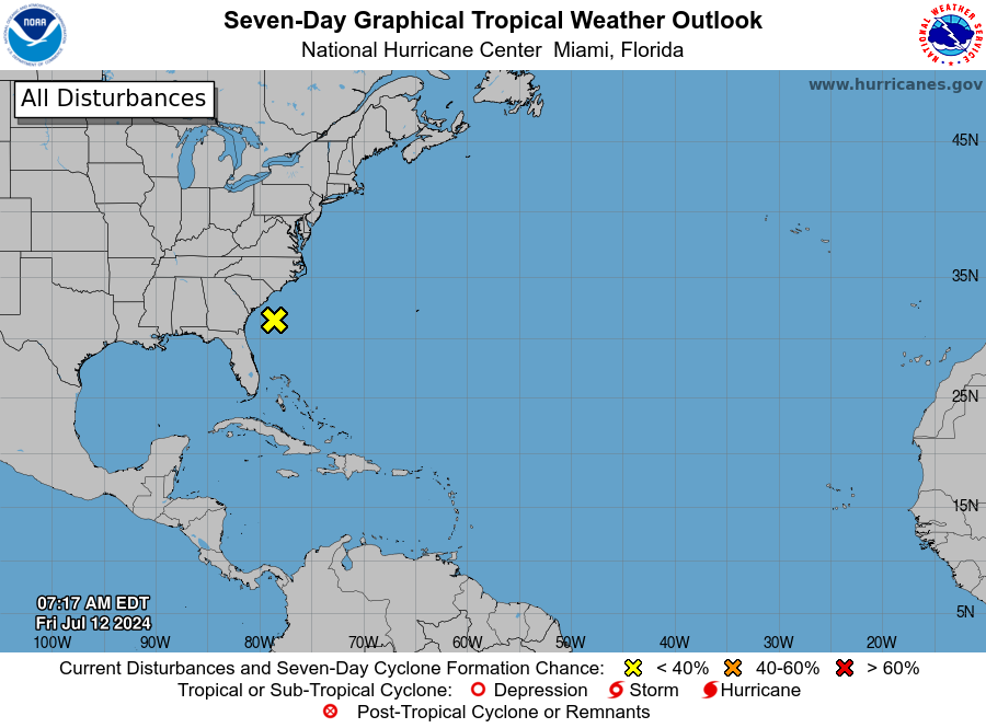
MIAMI, Florida – NOAA‘s National Hurricane Center in Miami, Florida, issued a Tropical Weather Outlook at 8 a.m. Eastern Daylight Time on Friday, July 12, 2024, due to the presence of a system that is unlikely to form into a tropical cyclone within the next 7 days off the east coast of North Carolina and South Carolina.
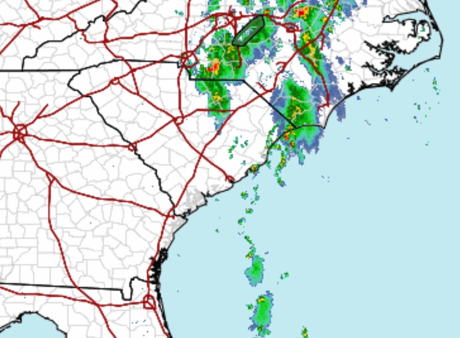
The system (marked with a yellow “X”) is a broad broad area of low pressure located about a hundred miles off the coast of South Carolina that continues to produce disorganized showers and thunderstorms.
NHC forecasters say that strong upper-level winds should limit any development of this system before it moves inland over South Carolina and North Carolina later today.
However, the disturbance could contribute to areas of heavy rainfall and possible flash flooding across coastal portions of the Carolinas and Mid-Atlantic through tonight.
This system has a 0% chance of tropical cyclone formation within the next 7 days and a 0% chance within the next 48 hours.
The next name on the 2024 Atlantic Hurricane List is Debby.
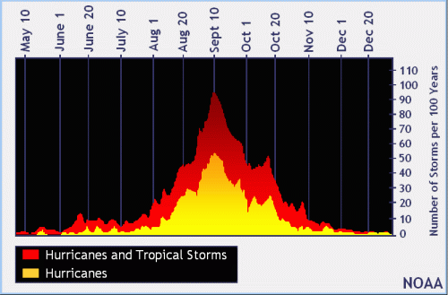
NOAA and Colorado State University forecast an “extremely active” 2024 Atlantic Hurricane Season, which runs from June 1 through November 30.
| NOAA historical hurricane data. Peak season and storm frequency. |
Although peak hurricane season isn’t until September 10, the weeks after July 10 is when tropical storm and hurricane activity begins to pick up, according to NOAA and the National Weather Service‘s historical hurricane activity data.
Copyright 2023-2025 FloridaWord.com