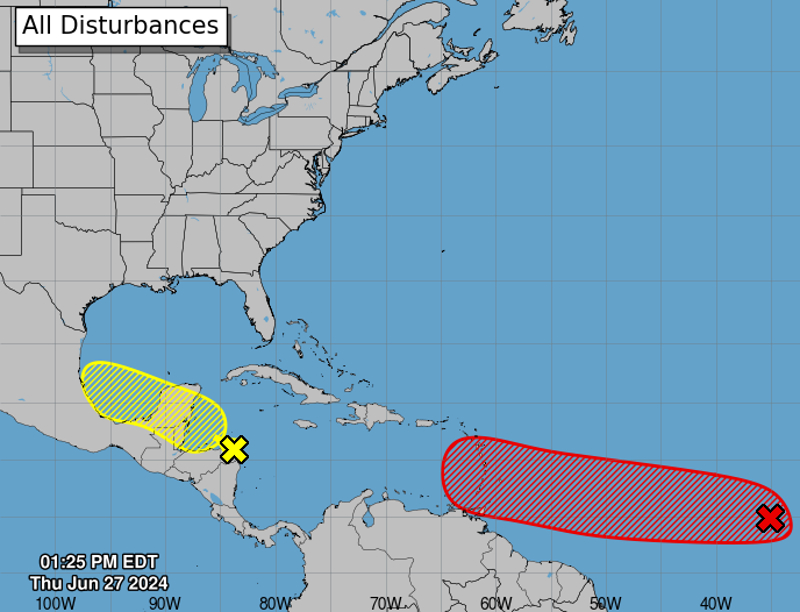
MIAMI, Florida – NOAA‘s National Hurricane Center in Miami, Florida, issued a Tropical Weather Outlook at 2 p.m. Eastern Daylight Time on Thursday, June 27, 2024, due to the presence of a system that may form into a tropical cyclone within the next 7 days.
The system, dubbed Invest 94L, is a tropical wave over the western Caribbean Sea that is producing widespread but disorganized shower and thunderstorm activity while it moves westward at around 15 mph (marked with a yellow “X”).
NHC forecasters say that environmental conditions could support some gradual development once the wave reaches the western Caribbean Sea late this week, and some development is also possible over the southwestern Gulf of Mexico during the weekend.
This system has a 30% chance of tropical cyclone formation within the next 7 days and a 10% chance within the next 48 hours.
Spaghetti models are in general agreement that Invest 94L will move west-northwestward towards Honduras, Belize, and the southern Yucatan Peninsula.
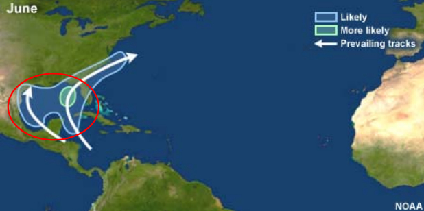
| NOAA Prevailing Atlantic Hurricane Tracks June |
If this system develops into a tropical storm or hurricane, the next name on the 2024 Atlantic Hurricane List is Beryl.
NOAA and Colorado State University forecast an ‘extremely active’ 2024 Atlantic Hurricane Season, which runs from June 1 through November 30.
RELATED:
Copyright 2023-2025 FloridaWord.com