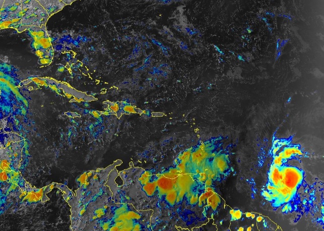
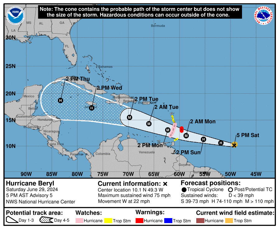
MIAMI, Florida – NOAA‘s National Hurricane Center issued a Public Advisory at 5 p.m. Eastern Daylight Time on Saturday, June 29, 2024, due to the presence of Hurricane Beryl, the first named hurricane of the 2024 Atlantic Hurricane Season. which is forecast to rapidly strengthen into a Category 3 hurricane over the Caribbean.
Hurricane Beryl (formerly Tropical Depression Two and Invest 95L) is located 720 miles east-southeast of Barbados and is moving to the west at 22 mph (35 km/h). NHC forecasters say that a relatively quick westward to west-northwestward motion is expected during the next few days.
On the official NHC forecast track, the Beryl is expected to move across the Windward Islands late Sunday night and Monday.
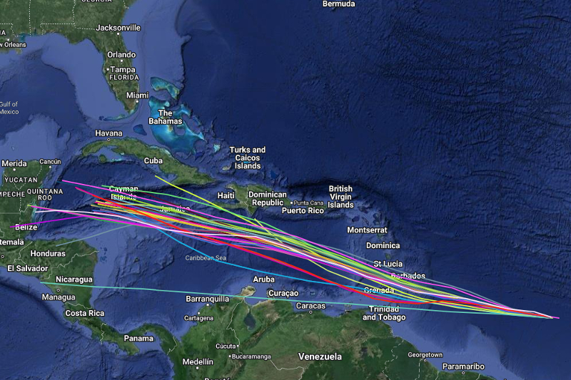
Computer models, often referred to as spaghetti models, are in general agreement that Hurricane Beryl will move west-northwest towards the Lesser Antilles. However, there is a fair amount of spread in the model guidance, especially after 72 hours.
The GFS-based (American model) guidance calls for the storm to continue west-northwestward, while the ECMWF (European model) and UKMET models show a more westward motion. The official NHC track forecast is in fairly good agreement with the various consensus models.
Hurricane Beryl has maximum sustained winds of 75 mph (120 km/h), with higher gusts.
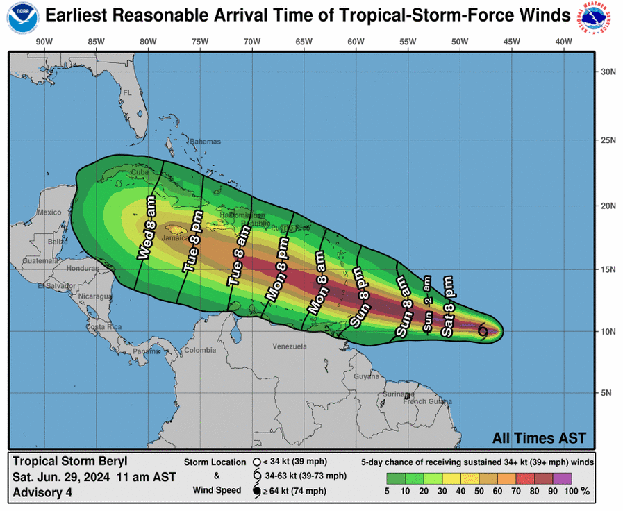
Hurricane-force winds extend outward up to 10 miles (20 km) from the center of the tropical cyclone and tropical-storm-force winds extend outward up to 60 miles (95 km).
The official NHC forecast calls for rapid strengthening and shows Beryl becoming a Major Category 3 hurricane on the Saffir-Simpson Hurricane Wind Scale before it reaches the Windward Islands.
A Hurricane Warning is in effect for Barbados.
A Hurricane Warning means that hurricane conditions are expected somewhere within the warning area. A warning is typically issued 36 hours before the anticipated first occurrence of tropical-storm-force winds, conditions that make outside preparations difficult or dangerous. Preparations to protect life and property should be rushed to completion.
A Hurricane Watch is in effect for St Lucia, St. Vincent and the Grenadine Islands, Grenada.
A Hurricane Watch means that hurricane conditions are possible within the watch area. A watch is typically issued 48 hours before the anticipated first occurrence of tropical-storm-force winds, conditions that make outside preparations difficult or dangerous.
A Tropical Storm Watch is in effect for Martinique, Dominica, Tobago.
A Tropical Storm Watch means that tropical storm conditions are possible within the watch area, generally within 48 hours.
Interests elsewhere in the Lesser Antilles should closely monitor the progress of Beryl. Additional watches and warnings will likely be required for portions of this area this evening.
NOAA and Colorado State University forecast an “extremely active” 2024 Atlantic Hurricane Season, which runs from June 1 through November 30.
Copyright 2023-2025 FloridaWord.com