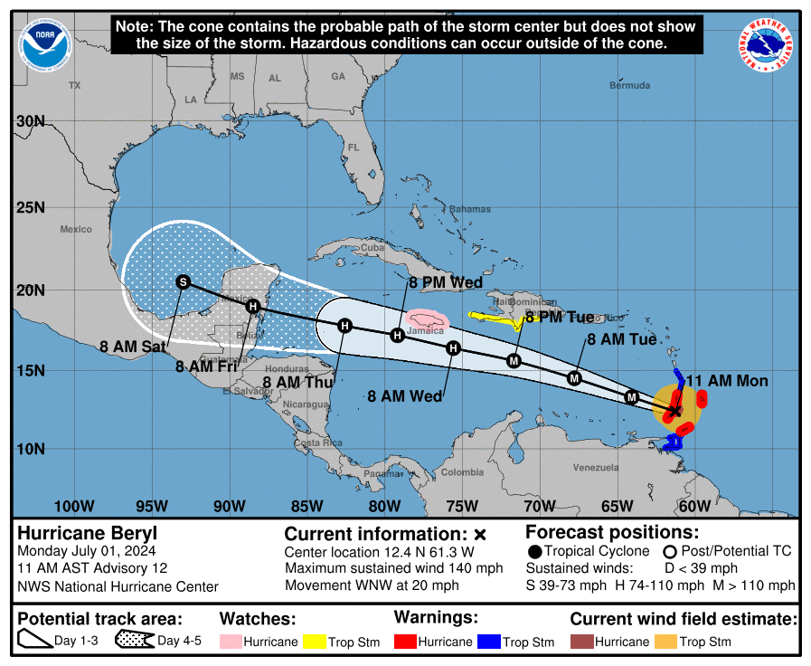
MIAMI, Florida – NOAA‘s National Hurricane Center issued an updated Public Advisory at 11:10 a.m. Eastern Daylight Time on Monday, July 1, 2024, due to the presence of Hurricane Beryl over the Caribbean, the first named hurricane of the 2024 Atlantic Hurricane Season.
Hurricane Beryl (formerly Tropical Depression Two and Invest 95L) is located 30 miles north-northeast east of Grenada and is moving to the west-northwest at 20 mph (31 km/h).
NHC forecasters say that a continued quick westward to west-northwestward motion is expected during the next few days.
On the official NHC forecast track, the center of Beryl is expected to move across the Windward Islands this morning and across the southeastern and central Caribbean Sea late Monday through Wednesday.
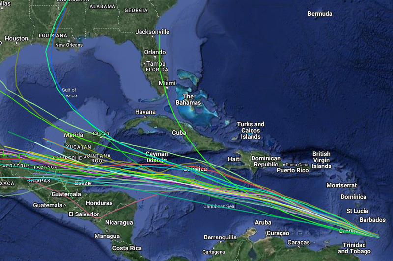
Computer models, often referred to as spaghetti models, are in general agreement that Hurricane Beryl will move west-northwest over the Caribbean.
There is a significant spread among the computer models (GFS-based American model, ECMWF European model, and UKMET model) after 48 hours once the tropical cyclone passes Jamaica.
The NHC track forecast is similar to the previous prediction and lies close to the various consensus aids.
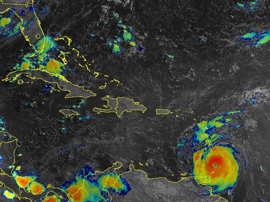
Beryl has re-strengthened into a Category 4 hurricane on the Saffir-Simpson Hurricane Wind Scale with maximum sustained winds of 150 mph (240 km/h), with higher gusts.
Fluctuations in strength are likely during the next day or so, but Beryl is expected to remain an extremely dangerous major hurricane as its core moves through the Windward Islands into the eastern Caribbean.
Some weakening is expected in the central Caribbean by midweek, though Beryl is forecast to remain a hurricane.
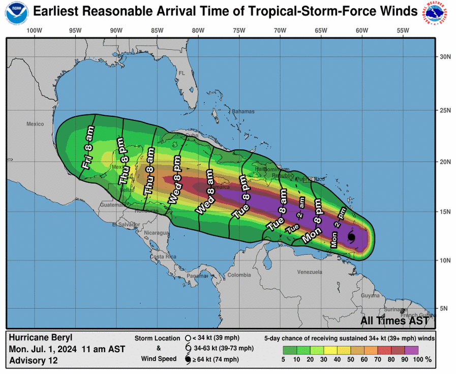
Hurricane-force winds extend outward up to 40 miles (65 km) from the center of the tropical cyclone and tropical-storm-force winds extend outward up to 125 miles (205 km).
A Hurricane Warning is in effect for Barbados, St. Vincent and the Grenadine Islands, Grenada, and Tobago.
A Hurricane Warning means that hurricane conditions are expected somewhere within the warning area. A warning is typically issued 36 hours before the anticipated first occurrence of tropical-storm-force winds, conditions that make outside preparations difficult or dangerous. Preparations to protect life and property should be rushed to completion.
A Hurricane Watch is in effect for Jamaica.
A Tropical Storm Warning is in effect for Martinique, St. Lucia, and Trinidad.
A Tropical Storm Warning means that tropical storm conditions are expected somewhere within the warning area within 36 hours.
A Tropical Storm Watch is in effect for Trinidad, the south coast of Dominican Republic from Punta Palenque westward to the border with Haiti, and the entire south coast of Haiti from the border of the Dominican Republic to Anse d’Hainault.
A Tropical Storm Watch means that tropical storm conditions are possible within the watch area, generally within 48 hours.
Interests elsewhere in the Lesser Antilles, Hispaniola, Jamaica, the Cayman Islands and the remainder of the northwestern Caribbean should closely monitor the progress of Beryl. Additional watches or warnings may be required later tonight or Monday.
NOAA and Colorado State University forecast an “extremely active” 2024 Atlantic Hurricane Season, which runs from June 1 through November 30.
RELATED:
Copyright 2023-2025 FloridaWord.com