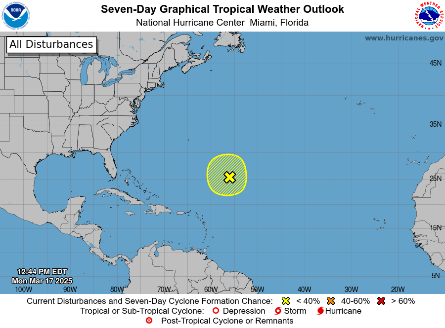
MIAMI, Florida – NOAA‘s National Hurricane Center in Miami, Florida, issued a Special Tropical Weather Outlook at 12:20 p.m. Eastern Daylight Time on Monday, March 17, 2025, due to the unseasonal presence of a system located far off of the Florida coast over the Atlantic.
The system (marked with a yellow shaded area) is a non-tropical area of low pressure located about 700 miles northeast of the northern Leeward Islands that is producing gale-force winds and a large area of disorganized showers and thunderstorms.
NHC forecasters say that additional development of this low is not expected as it moves northward to northwestward into an environment of strong upper-level winds and dry air tonight and Tuesday.
This system has a 10% chance of tropical cyclone formation within the next 7 days and a 10% chance within the next 48 hours.
Although the Atlantic Hurricane Season doesn’t officially start until June 1st, tropical cyclones have formed during the Spring and Winter.
The earliest named storm was Tropical Storm Alex which formed on January 12, 2016.


