NOAA National Hurricane Center Tropical Weather Outlook for June 10, 2026.
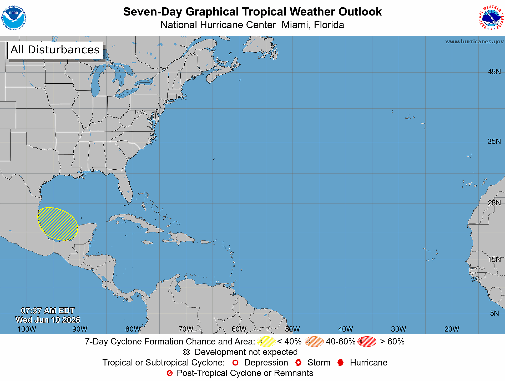
MIAMI, Florida – NOAA‘s National Hurricane Center in Miami, Florida, issued a Tropical Weather Outlook at 8:00 AM Eastern Daylight Time on Wednesday, June 10, 2026, due to the presence of a system that may form into a tropical cyclone within the next 7 days over the Bay of Campeche.
If this system develops into a tropical storm or hurricane, the next name on the 2026 Atlantic Hurricane List is Arthur.
The system is a broad area of low pressure that could form over the Bay of Campeche late this week.
NHC forecasters say that conditions are not expected to be favorable for significant development, and the system should move inland over eastern Mexico late this weekend.
This system has a near 0% chance of tropical cyclone formation within the next 48 hours and a 10% chance within the next 7 days.
NOAA forecasts a “below-normal” 2026 Atlantic Hurricane Season, which runs from June 1 through November 30.
Although peak hurricane season isn’t until September 10, hurricane and tropical storm activity begins to pick up in late June, according to NOAA and the National Weather Service‘s historical hurricane activity data.
8 AM EDT Wednesday, June 10: A broad area of low pressure could form over the Bay of Campeche later this week. The system has a low chance (10%) of formation before it moves inland over eastern Mexico over the weekend. Follow the latest at https://t.co/tW4KeGdBFb pic.twitter.com/n1F3Plt4fN
— National Hurricane Center (@NHC_Atlantic) June 10, 2026
Copyright 2023-2025 FloridaWord.com

