NOAA National Hurricane Center Tropical Weather Outlook June 27, 2025.
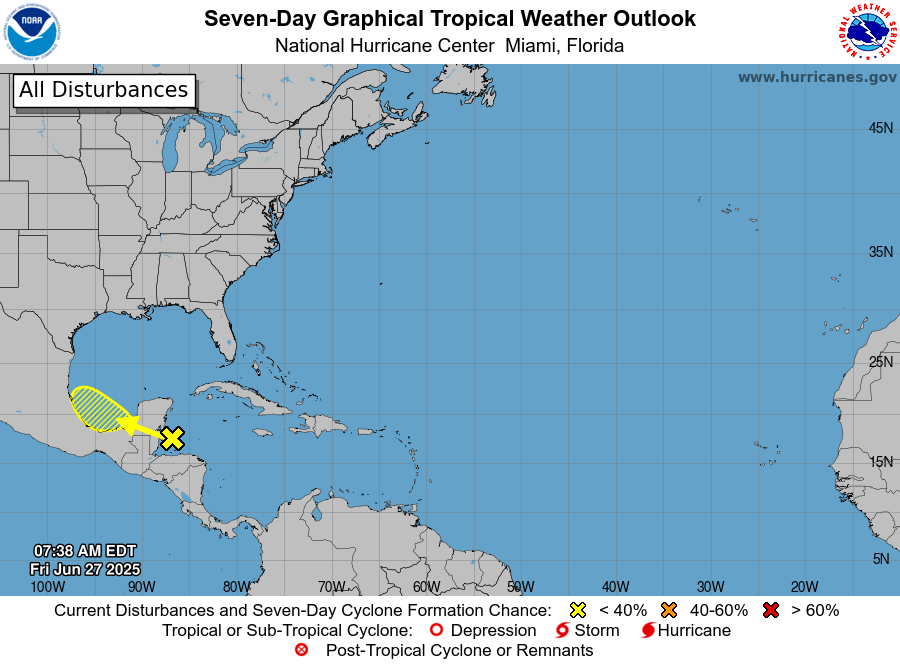
MIAMI, Florida – NOAA‘s National Hurricane Center in Miami, Florida, issued a Tropical Weather Outlook at 8:00 AM Eastern Daylight Time on Friday, June 27, 2025, due to the presence of of a system that may form into a tropical cyclone within the next 7 days over the western Caribbean.
If this system develops into a tropical storm or hurricane, the next name on the 2025 Atlantic Hurricane List is Barry.
The system is an area of disorganized showers and thunderstorms over the northwestern Caribbean sea and the adjacent land aareasthat is expected to move west-northwestward into the Bay of Campeche Saturday or Saturday night, where an area of low pressure could form.
NHC forecasters say that subsequent development is possible on Sunday or Monday if the system remains offshore of the coast of Mexico.
Regardless of development, locally heavy rains are possible over portions of Belize, Guatemala, and southeastern Mexico during the next few days.
This system has a 20% chance of tropical cyclone formation within the next 7 days and a 10% chance within the next 48 hours.
NOAA forecasts an “above-normal” 2025 Atlantic Hurricane Season, which runs from June 1 through November 30.
Although peak hurricane season isn’t until September 10, hurricane and tropical storm activity begins to pick up in late June, according to NOAA and the National Weather Service‘s historical hurricane activity data.
Copyright 2023-2025 FloridaWord.com

