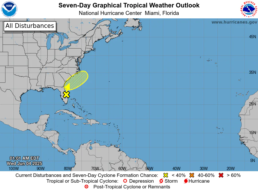
Seven-day tropical weather outlook from the National Hurricane Center, issued on June 4, 2025, showing a low (less than 40%) chance of cyclone formation off the southeastern U.S. coast over the next week.
MIAMI, Florida – NOAA‘s National Hurricane Center in Miami, Florida, issued a Tropical Weather Outlook at 8 a.m. Eastern Daylight Time on Wednesday, June 4, 2025, due to the presence of a system located off of Florida’s east coast.
Showers and thunderstorms located over the Florida peninsula, southeastern Georgia, the northwestern Bahamas, and the adjacent Atlantic and Gulf waters (marked with a yellow “X” near Florida) are associated with a broad trough of low pressure.
NHC forecasters say a non-tropical low pressure area is forecast to form from this system on Thursday, but it is becoming increasingly likely that this development will occur inland over South Carolina and North Carolina.
As a result, the low’s chances of acquiring subtropical or tropical characteristics have diminished.
Regardless of development, heavy rainfall could cause some flash flooding along portions of the southeastern U.S. coast today and on Thursday.
This system has a 0% chance of tropical cyclone formation within the next 7 days and a 0% chance within the next 48 hours.
If this system had developed into a tropical storm or hurricane, the first name on the 2025 Atlantic Hurricane List is Andrea.
NOAA forecast an “above-average” 2025 Atlantic Hurricane Season, which runs from June 1 through November 30.
Copyright 2023-2025 FloridaWord.com

