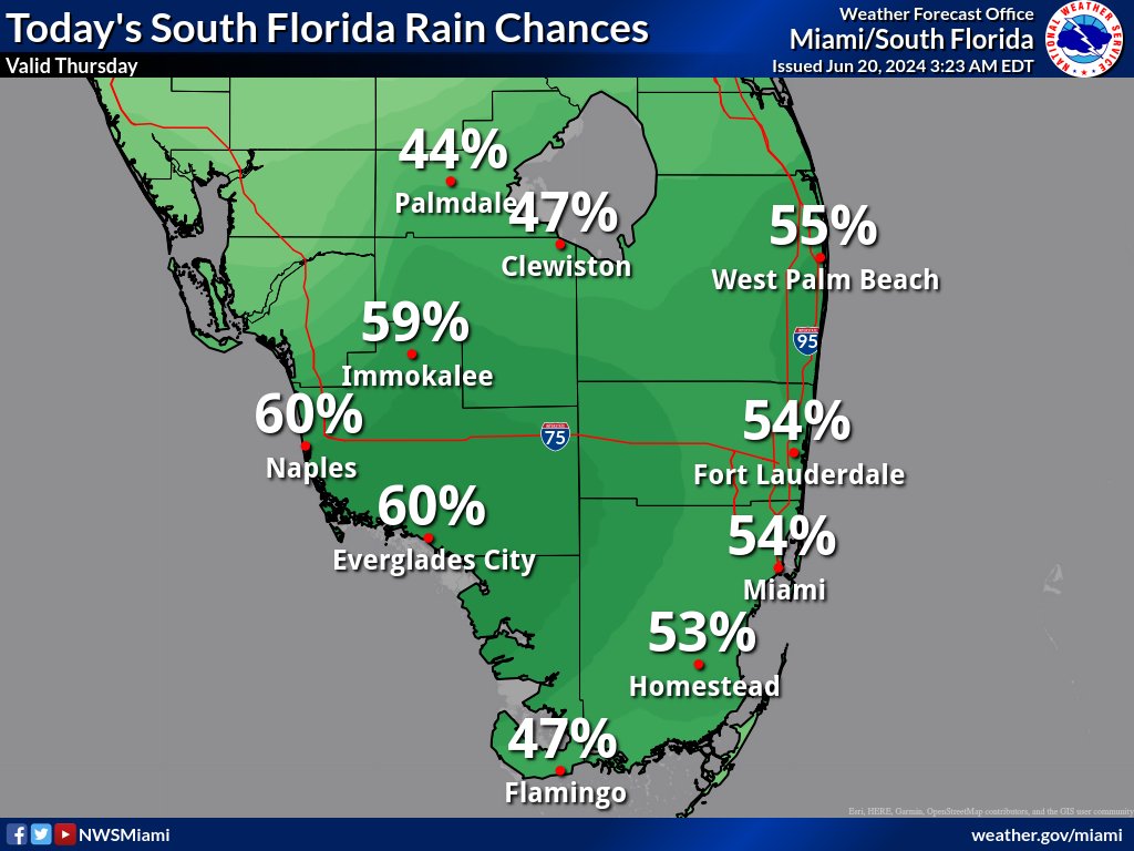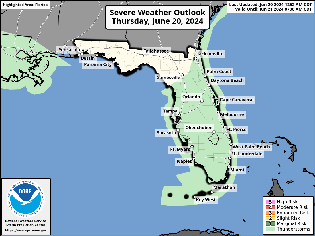
MIAMI, Florida – Isolated to scattered thunderstorms will develop this afternoon across South Florida, including Miami-Dade, Palm Beach, Collier, and Broward counties.
The strongest storms could contain gusty winds, heavy rain, and frequent lightning, according to the the National Weather Service Storm Prediction Center.
Scattered thunderstorms will be possible through the rest of the week and into the weekend as moisture increases ahead of an approaching area of low pressure over the western Atlantic.
This low is forecast to track toward the eastern Florida peninsula and conditions may become conducive for this feature to develop.
The strongest thunderstorms could contain gusty winds and heavy downpours. Any heavy downpours could create the potential for additional flooding concerns.
The risk of rip currents will continue into the second half of the week across the Atlantic Coast beaches as onshore flow remains robust.
Peak heat indices over 100 degrees are expected Friday through the weekend.
Copyright 2023-2025 FloridaWord.com