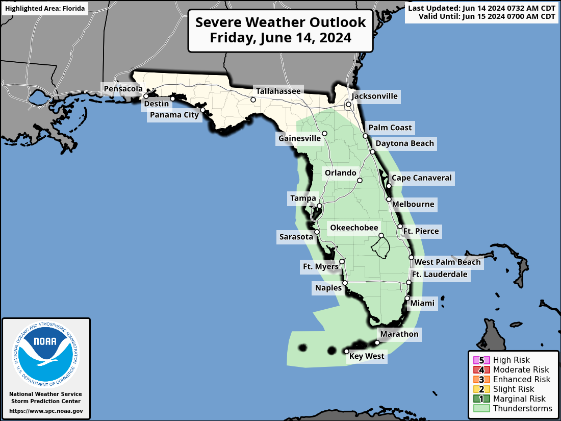
MIAMI, Florida – Scattered to numerous thunderstorms produced by Invest 90L will continue today and tonight, on Friday, June 14, 2024, across South Florida and Central Florida, according to the National Weather Service Hazardous Weather Outlook.
Stronger storms will be capable of producing gusty winds of over 40 mph, frequent cloud-to-ground lightning, and torrential downpours that can cause localized flash flooding and ponding on roadways.
These thunderstorms are forecast to bring excessive rainfall to the southern half of the Florida peninsula where record rainfall amounts of up to 20 inches have already accumulated in parts of South Florida.
Florida Governor Ron DeSantis declared a State of Emergency due to the flooding in South Florida.
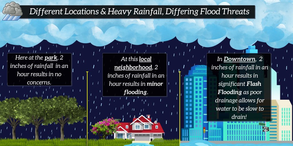
The same amount of rainfall in a short duration of time can cause widely different impacts depending on where it falls.
For example, urban areas such as Downtown Miami and Miami Beach have lower thresholds for flooding due to the built environment and drainage patterns.
The City of Miami is improving storm water infrastructure to help drain the concrete jungle faster during heavy rains and also encourages residents and businesses to use permeable alternatives to asphalt parking lots and driveways, such as gravel, paving stones, and paved strips.
Copyright 2023-2025 FloridaWord.com