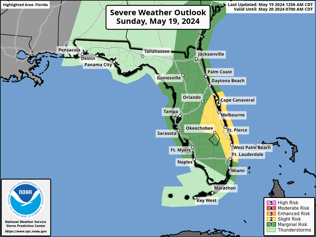
MIAMI, Florida – Strong to locally severe thunderstorms capable of producing isolated tornadoes, damaging wind gusts, large hail, and frequent cloud-to-ground lightning will be possible across Florida, according to the National Weather Service Storm Prediction Center.
Severe Thunderstorm Watch Issued For South Florida
The greatest chance for severe weather is from 2 p.m. to 8 p.m. along the eastern half of the Florida peninsula from east of Orlando southward to Fort Lauderdale.
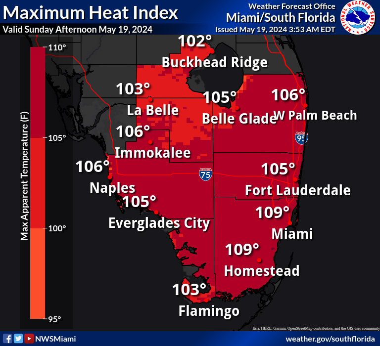
The afternoon thunderstorms may bring relief to some areas from the excessive heat in the 90’s with a heat index above 100 that is forecast across South Florida.
Elsewhere, a marginal risk for severe weather extends from Jacksonville to Tampa to Naples to Miami.
Copyright 2023-2025 FloridaWord.com