National Weather Service Rain Chances for Florida Florida on Saturday, July 4, 2026
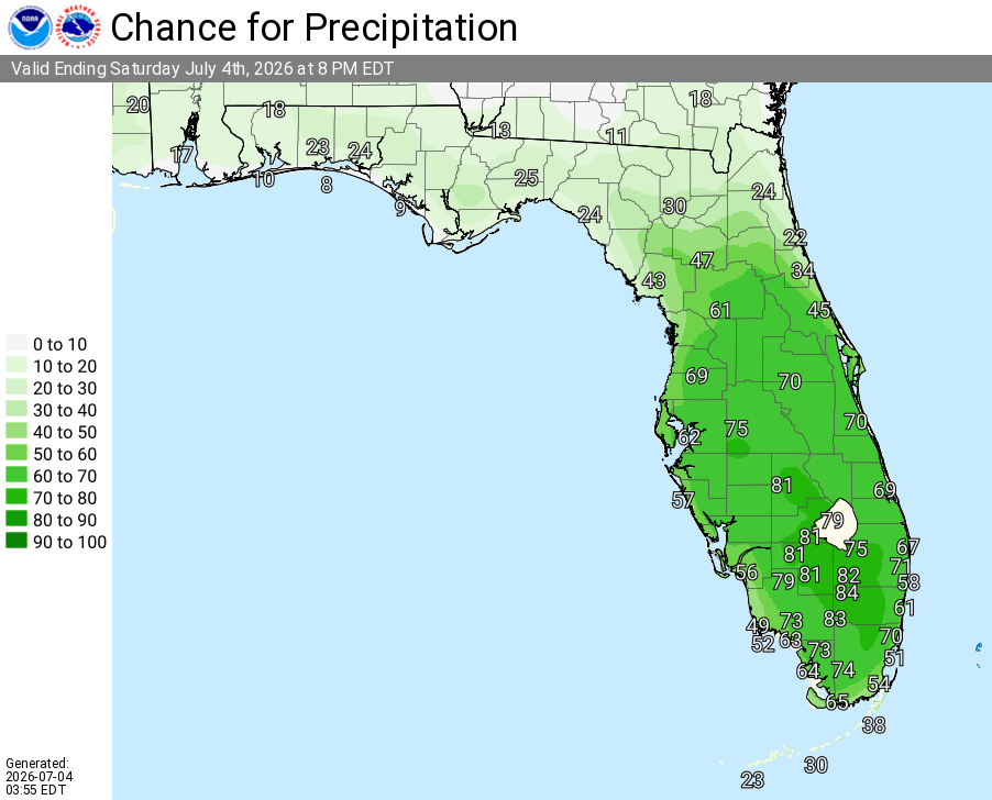
ORLANDO, Florida – The National Weather Service in Melbourne forecasts high coverage of showers and thunderstorms across East Central Florida today for Independence Day, with the highest coverage anticipated this afternoon. Highs will remain in the lower 90s°F this afternoon.
Showers and storms will increase in coverage this afternoon as the sea breeze develops and moves inland, then taper off through the evening. Storms may produce frequent lightning, gusty winds, and locally heavy rainfall. Highest storm chances are expected across much of the area this afternoon.
National Weather Service Melbourne – Independence Day Forecast (July 4, 2026)
The main hazards during peak storm hours this afternoon include:
Exercise caution at Atlantic beaches due to a High Risk of rip currents along portions of the Volusia and northern Brevard County coasts (including Daytona, New Smyrna, and Playalinda areas). Moderate risk exists elsewhere. Swim near lifeguards and never enter the surf alone.
Stay hydrated and take breaks in the shade or air conditioning as muggy conditions build with heat indices reaching 102–107°F this afternoon.
East Central Florida cities forecast today include:
Copyright 2023-2025 FloridaWord.com


