National Weather Service Rain Chances for Florida Florida on Friday, July 3, 2026
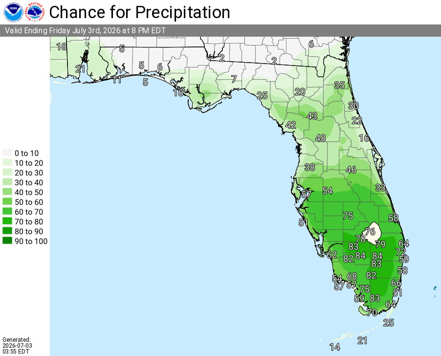
JACKSONVILLE, Florida – The National Weather Service in Jacksonville has issued a Thunderstorm Outlook for Friday, July 3, 2026, with isolated strong thunderstorms possible near the I-75 corridor in north central Florida and the Suwannee Valley this afternoon and evening.
Thunderstorm activity is expected to develop this afternoon and continue through mid-evening hours. The strongest storms are anticipated near the I-75 corridor as flow interacts with boundaries.
According to the National Weather Service in Jacksonville, the primary threats from stronger storms are wind gusts of 35-45 mph, frequent lightning, and heavy downpours that could lead to localized minor flooding.
National Weather Service Jacksonville Thunderstorm Outlook for North Central Florida, Friday, July 3, 2026.
According to NWS Jacksonville, isolated strong thunderstorms are possible today near the I-75 corridor in north central Florida and the Suwannee Valley, with the main focus along the I-75 corridor.
Storms today may produce:
The storms are expected to bring beneficial rainfall across parts of the region where they develop. Outdoor enthusiasts should have a safe shelter plan ready this afternoon and evening.
National Weather Service Jacksonville Weather Radar for Northeast Florida
Areas at highest risk for strong thunderstorms today include:
Copyright 2023-2025 FloridaWord.com


