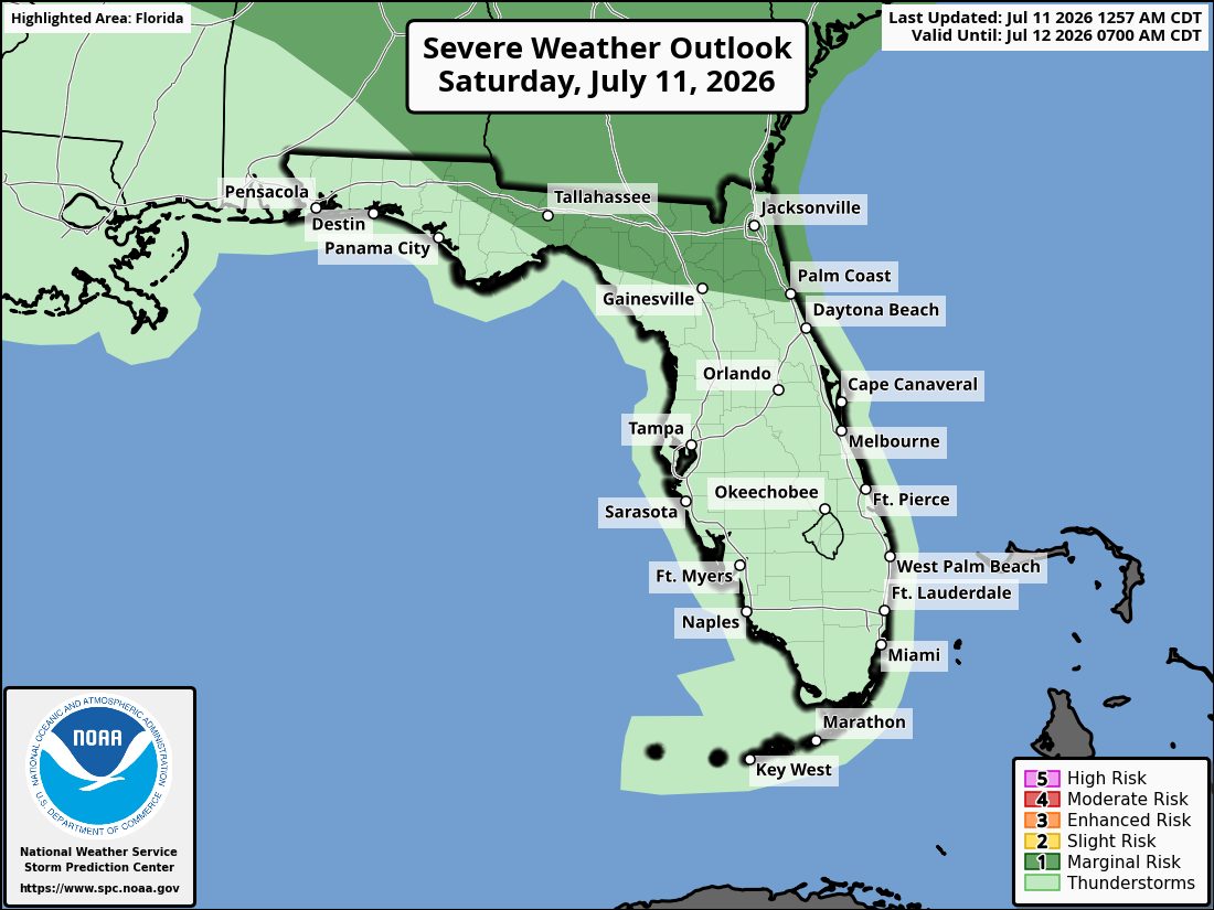
National Weather Service Storm Prediction Center Severe Weather Outlook for Florida for Saturday, July 11, 2026.
TALLAHASSEE, Florida – A Heat Advisory is in effect this afternoon for the Florida Panhandle, western Big Bend, southeast Alabama’s Wiregrass region, and southwest Georgia, according to the National Weather Service in Tallahassee. High temperatures will reach the mid to upper 90s°F with heat indices of 104-110°F (locally higher in spots).
The Storm Prediction Center has issued a Marginal Risk (Level 1 of 5) of severe thunderstorms across the region today. A Marginal Risk means isolated severe storms are possible, though coverage and intensity are expected to remain limited.
Scattered strong to possibly severe storms are possible this afternoon through early evening, especially across the Florida Panhandle, Big Bend, and west of a line from Panama City to Albany. Storms will weaken as they move southeast.
Primary hazards with any stronger storms include damaging wind gusts of 60+ mph, frequent lightning, and locally heavy downpours. Hail is possible in the strongest cells. Lightning remains a concern with all thunderstorms.
On a positive note, beneficial rainfall is expected with any storms today, helping to ease ongoing dry conditions. Additional rain chances increase Sunday across the broader region.
Florida cities at risk for thunderstorms and possible strong to severe weather today include:
High temperatures across the Florida Panhandle and north Florida will be in the mid to upper 90s °F (heat index 104-110°F+ in Heat Advisory areas). Overnight lows will drop into the mid to upper 70s.
TALLAHASSEE WEATHER FORECAST
Copyright 2023-2025 FloridaWord.com