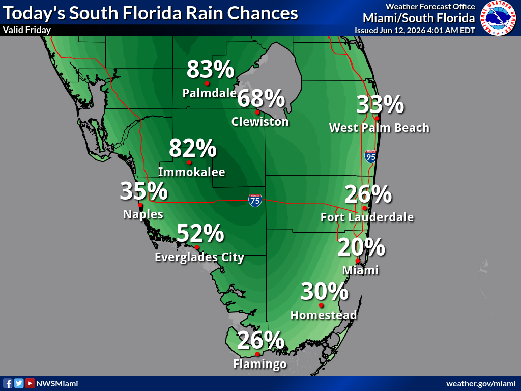
National Weather Service Miami graphic showing today’s rain chances across South Florida on Friday, June 12, 2026.
MIAMI, Florida – The National Weather Service in Miami forecasts scattered showers and thunderstorms for South Florida today, Friday, June 12, 2026, with the highest rain chances over the interior and western regions during the afternoon and early evening hours.
Stronger storms could produce heavy downpours, frequent lightning, and gusty winds. The east coast metro corridor from West Palm Beach through Fort Lauderdale to Miami will see much lower chances and should stay mostly dry with only isolated activity possible.
(As of the latest NWS probabilistic outlook – Valid Friday, June 12, 2026)
High humidity will make it feel significantly hotter than the actual air temperatures. Peak heat index values this afternoon are expected to reach:
Today (Friday)
Partly sunny, with a high near 87°F. A 20% chance of showers and thunderstorms after 2pm. Southeast wind 5 to 10 mph.
Tonight
Mostly cloudy, with a low around 80°F. A 10% chance of showers and thunderstorms before 7pm. Southeast wind 3 to 7 mph.
Saturday
Mostly sunny, with a 30% chance of showers and thunderstorms mainly after 5pm. High near 88°F. Light and variable wind becoming southeast 5 to 9 mph in the afternoon.
Saturday Night
Partly cloudy, with a 10% chance of showers and thunderstorms before 8pm. Low around 80°F.
Sunday
Sunny, with a 30% chance of showers and thunderstorms after 2pm. High near 89°F.
Sunday Night
Mostly clear, with a 30% chance of showers and thunderstorms before 8pm. Low around 80°F.
Source: National Weather Service Miami/South Florida (weather.gov/mfl). Graphics issued June 12, 2026. Always check the official NWS site for the most current information.
Copyright 2023-2025 FloridaWord.com

