National Weather Service Rain Chances for Florida Florida on Thursday, June 25, 2026.
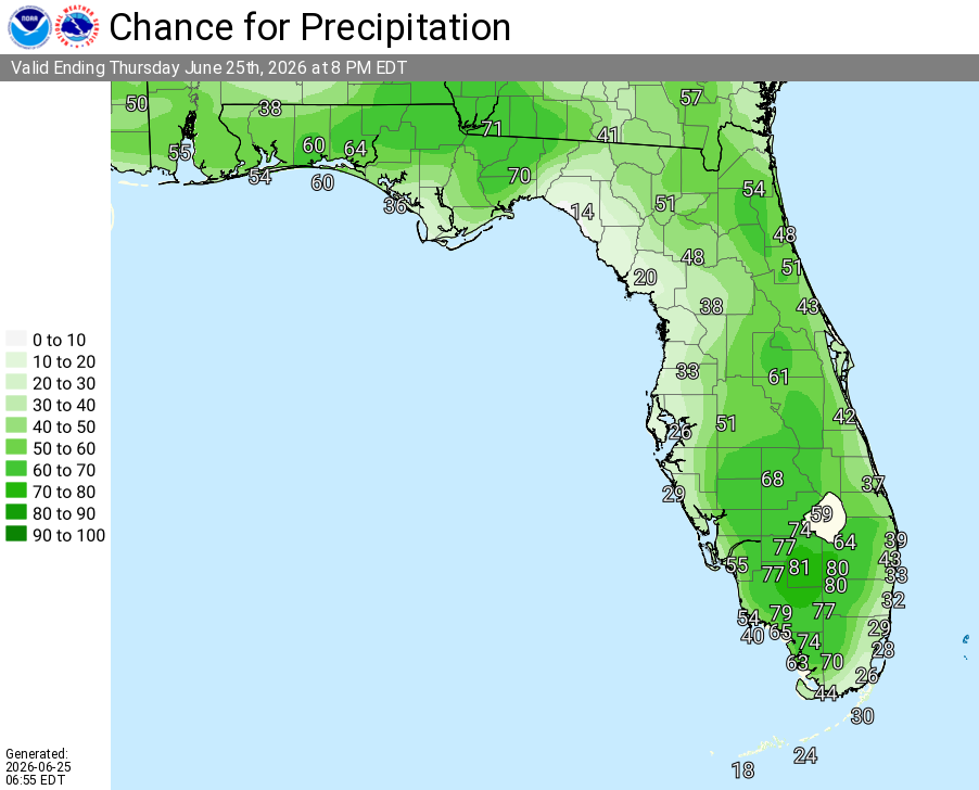
TALLAHASSEE, Florida – The National Weather Service is highlighting a Moderate Risk for Excessive Rainfall today (Thursday, June 25, 2026) across southeast Alabama’s Wiregrass region, southwest Georgia, and the Florida Panhandle.
The Weather Prediction Center has placed portions of southeast Alabama, southwest Georgia, and the eastern Florida Panhandle under a Moderate Risk of excessive rainfall today.
According to the National Weather Service Tallahassee, showers and thunderstorms can be expected today and tomorrow. Heavy rain may lead to isolated flash flooding. Most areas are expected to receive significant rainfall, with the potential for dangerous and life-threatening flash flooding where the heaviest rain falls. Turn Around, Don’t Drown!
The main hazards with thunderstorms today are frequent dangerous lightning, heavy rainfall capable of producing flash flooding, and a few gusty winds.
Headed to the beach today? There is a HIGH Risk for rip currents along Bay and Gulf County beaches (and portions of the Florida Panhandle) through late tonight. Rip currents can sweep even the best swimmers away from shore into deeper water. Please heed beach flags and swim near a lifeguard.
Cities at risk for thunderstorms, heavy rain, and possible localized flooding include:
Copyright 2023-2025 FloridaWord.com


