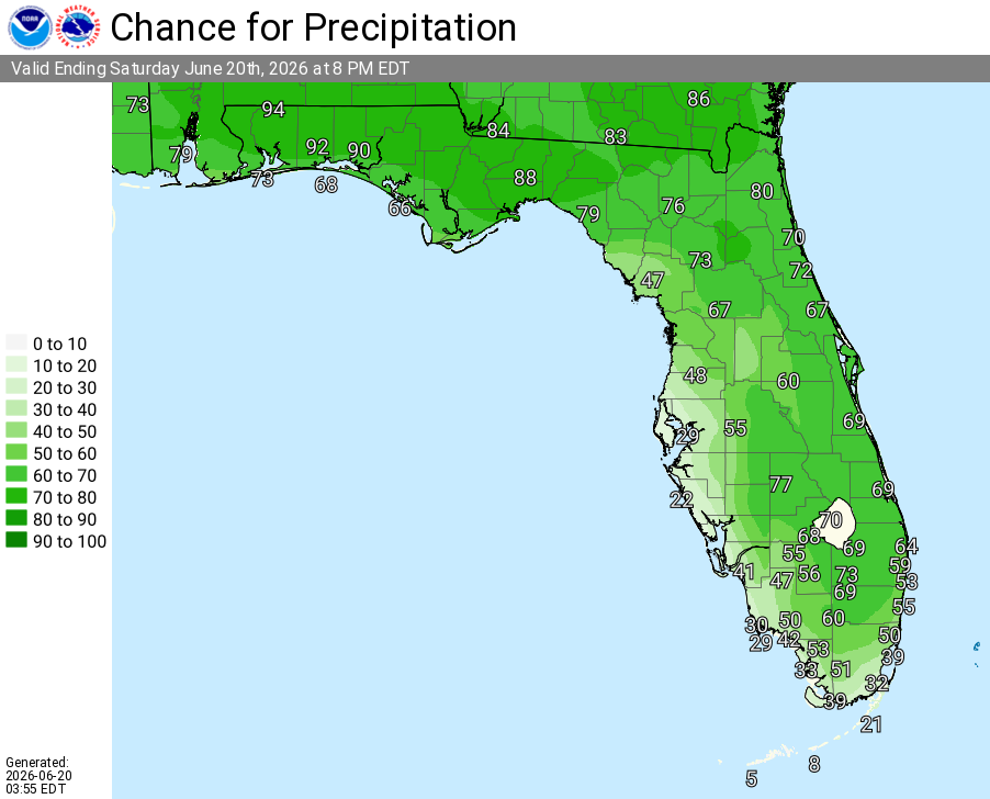
Orange County

Thunderstorms, Heavy Rainfall For East Central Florida

Published by
FLORIDA WORD

, Florida – The National Weather Service in Melbourne forecasts scattered to locally numerous showers and thunderstorms this Sunday, June 21, 2026, developing inland this afternoon and shifting eastward toward the coast and offshore through the afternoon and evening. Isolated strong storms will still be possible. Highs will be in the low 90s with peak heat indices of 100–105°F. No Heat Advisory is in effect today.

Melbourne – Today’s Outlook

The NWS warns of the following main hazards during peak storm hours this afternoon and evening:

  • Frequent lightning strikes
  • Locally heavy rainfall of 2–4 inches leading to minor flooding
  • Wind gusts up to 40–50 mph

Exercise caution at Atlantic beaches due to possible rip currents. Swim near lifeguards and never enter the surf alone.

East cities forecast to see warm temperatures today include:
  • Orlando (high near 93°F, 60% chance of rain/storms)
  • Daytona Beach (high near 91°F, 60% chance of rain/storms)
  • Melbourne (high near 90°F, 60% chance of rain/storms)
  • Vero Beach (high near 91°F, 40% chance of rain/storms)


National Weather Service Melbourne Central Florida Radar

Orlando Weather Forecast

Today
Showers and thunderstorms likely this afternoon. Mostly sunny becoming partly cloudy, with a high near 93°F. West wind 5 to 10 mph. Chance of precipitation is 50-70%. Heat index values up to 100-105°F.
Tonight
A chance of showers and thunderstorms, mainly before 8pm. Partly cloudy, with a low around 75°F. Chance of precipitation is 30%.
Monday
A chance of showers and thunderstorms after 5pm. Mostly sunny and hot, with a high near 95°F. Chance of precipitation is 30%. Heat index values up to 103°F.
Monday Night
A slight chance of showers before 7pm. Mostly clear, with a low around 77°F.
Published by
FLORIDA WORD

Contact Us    Privacy Policy

Copyright 2023-2025 FloridaWord.com