National Weather Service Rain Chances for Florida Florida on Friday, June 26, 2026.
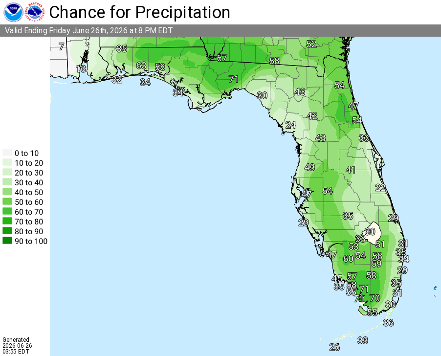
TAMPA BAY, Florida – The National Weather Service Tampa Bay is forecasting scattered showers and thunderstorms for the Nature Coast and West Central Florida on Friday, June 26, 2026, as hot and humid conditions continue into the weekend.
Hot and humid conditions will continue today with daytime highs in the low to mid 90s and heat index values reaching 100–107°F. No Heat Advisory is currently in effect, but the combination of temperatures and humidity will make it feel much hotter outdoors.
Scattered showers and isolated thunderstorms are expected to develop this afternoon and continue into the evening hours. The primary hazards include lightning, gusty winds, and locally heavy rainfall. Isolated stronger storms could produce damaging wind gusts capable of downing tree limbs and causing brief power outages.
The risk area includes the Nature Coast (Chiefland, Crystal River, Brooksville) through West Central Florida, including Tampa, St. Petersburg, Sarasota, and interior locations.
Thunderstorms will be driven by daytime heating and sea breeze interactions. Activity is expected to diminish after sunset.
Copyright 2023-2025 FloridaWord.com


