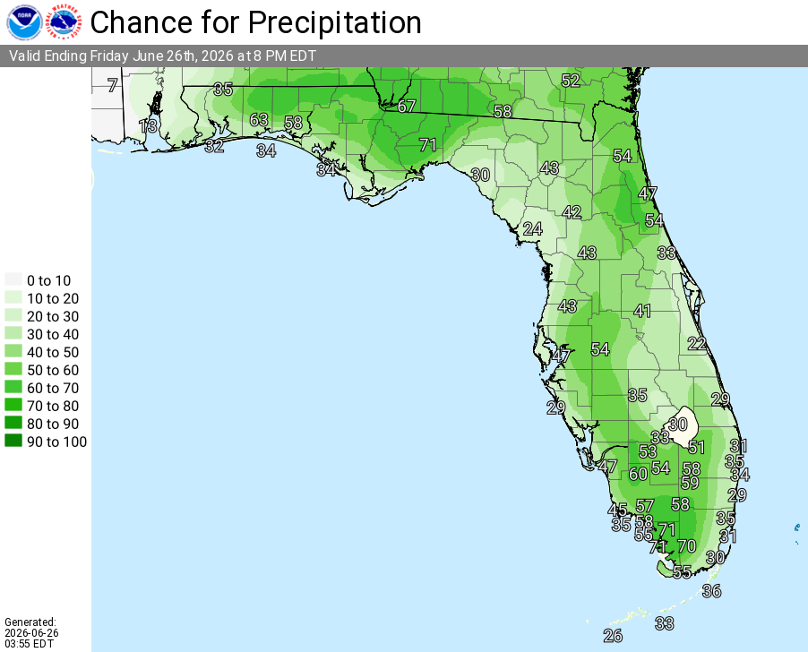
National Weather Service Rain Chances for Florida Florida on Friday, June 26, 2026.
ORLANDO, Florida – The National Weather Service in Melbourne forecasts a shower or two possible this morning south of Cape Canaveral, with strong thunderstorms developing this afternoon across East Central Florida, especially along the I-4 corridor. Heat indices will reach 102–106°F this afternoon.
Scattered to locally numerous showers and thunderstorms will develop inland this afternoon and shift eastward toward the coast and offshore through the afternoon and evening. Storms may produce frequent to excessive lightning, gusty to locally damaging winds, torrential rain, small hail, and isolated heavy rainfall amounts of 1–3 inches. A brief tornado or funnel cloud cannot be ruled out in the strongest storms. Hot and humid conditions will continue into the weekend.
National Weather Service Melbourne – Today’s Weather Outlook
The main hazards during peak storm hours this afternoon and evening include:
Exercise caution at Atlantic beaches due to possible rip currents. Swim near lifeguards and never enter the surf alone. Stay cool and hydrated with heat indices reaching 102–106°F this afternoon.
East Central Florida cities forecast to see warm temperatures today include:
Copyright 2023-2025 FloridaWord.com


