National Weather Service Rain Chances for Florida Florida on Sunday, June 28, 2026.
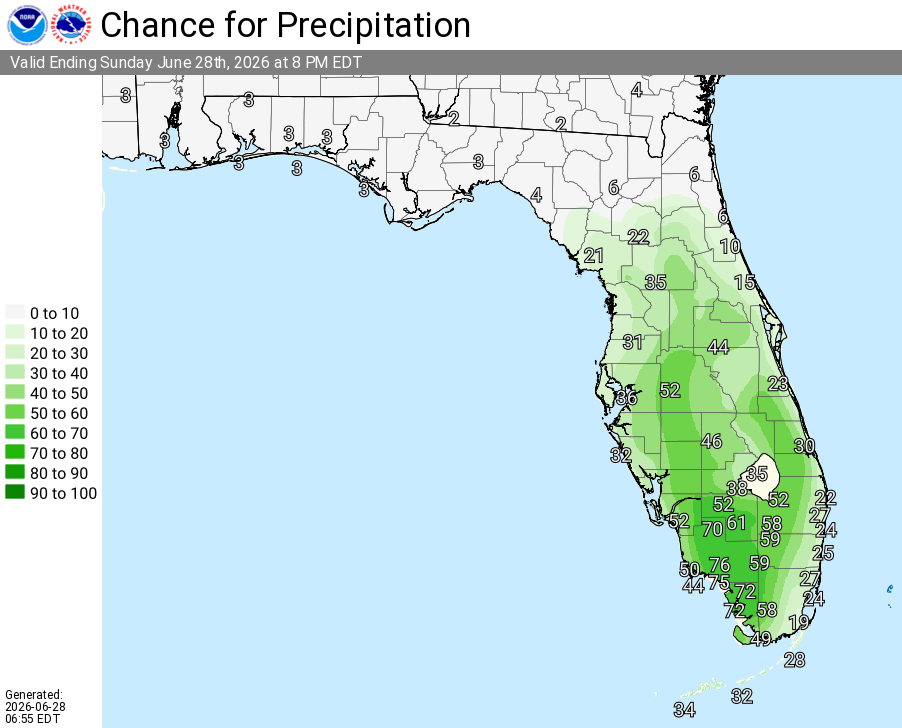
ORLANDO, Florida – The National Weather Service in Melbourne forecasts isolated to scattered showers and storms across East Central Florida today, primarily west of I-95. Lightning, wind gusts, and localized flooding will be possible. The heat also continues, with widespread Moderate to Major HeatRisk. Heat indices will reach 100–107°F this afternoon.
Isolated to scattered showers and thunderstorms are forecast today. Lightning strikes, wind gusts to 50 mph, heavy downpours, and localized flooding will be possible. Storms will develop mainly inland this afternoon and shift eastward toward the coast and offshore through the afternoon and evening.
National Weather Service Melbourne – Today’s Weather Outlook
The main hazards during peak storm hours this afternoon and evening include:
Exercise caution at Atlantic beaches due to a moderate risk of rip currents. Swim near lifeguards and never enter the surf alone. Stay cool and hydrated with heat indices reaching 100–107°F this afternoon. A Moderate to Major HeatRisk is forecast — practice heat safety: stay hydrated, take breaks in air conditioning or shade, and never leave children or pets in vehicles.
East Central Florida cities forecast to see warm temperatures today include:
Copyright 2023-2025 FloridaWord.com


