National Weather Service Rain Chances for Florida Florida on Tuesday, June 23, 2026.
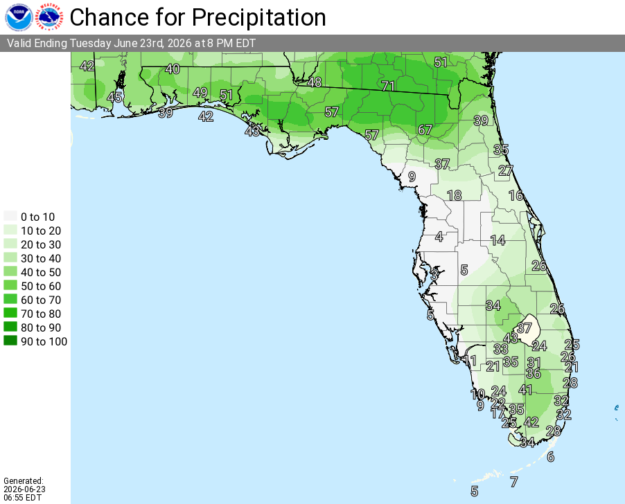
JACKSONVILLE, Florida – The National Weather Service in Jacksonville has issued a Thunderstorm Outlook for Tuesday, June 23, 2026, with scattered strong thunderstorms possible across parts of northeast Florida and southeast Georgia, mainly south of Waycross and St. Simons Island.
Thunderstorm activity is expected to develop this afternoon and continue through mid-evening hours. The strongest storms are anticipated closer to the I-95 corridor as southwest flow interacts with the sea breeze and other boundaries.
According to the National Weather Service in Jacksonville, the primary threats from stronger storms are damaging wind gusts of 40-55 mph (downburst winds), frequent lightning, and heavy downpours that could lead to localized minor flooding.
According to NWS Jacksonville, scattered strong thunderstorms are possible today across the region, with the main focus south of Waycross and St. Simons Island.
Storms today may produce:
The storms are expected to bring beneficial rainfall across parts of the region where they develop.
Areas at highest risk for strong thunderstorms today include:
Tuesday (Today)
Hot with a high near 95°F. Mostly sunny with a 30% chance of showers and thunderstorms, mainly after 4pm. Scattered strong storms possible in the afternoon and evening with damaging wind gusts up to 55 mph, frequent lightning, and locally heavy downpours. Heat index values as high as 106°F. West wind 8-11 mph with gusts up to 20 mph.
Tuesday Night
A 30% chance of showers and thunderstorms, mainly before 8pm. Partly cloudy. Low around 77°F. West wind 6-9 mph.
Copyright 2023-2025 FloridaWord.com


