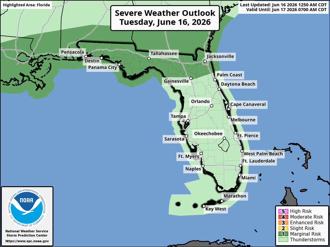
National Weather Service Storm Prediction Center Severe Weather Outlook for Florida on Tuesday, June 16, 2026.
JACKSONVILLE, Florida – The National Weather Service Storm Prediction Center has placed portions of southeast Georgia and northeast Florida under a Marginal Risk (level 1/5) for severe thunderstorms on Tuesday, June 16, 2026.
Isolated strong to severe thunderstorms are expected across southeast Georgia and northeast Florida, mainly during the afternoon and early evening hours.
The National Weather Service in Jacksonville is alerting residents of the severe storm risk today, particularly north of I-10 and across much of the area. The primary threats are damaging wind gusts of 40-60 mph and heavy rainfall.
According to NWS Jacksonville, isolated strong to severe thunderstorms are possible with the Marginal (1/5) risk level across northeast Florida and southeast Georgia.
Storms on Tuesday may produce:
The storms are expected to bring widespread beneficial rainfall, providing needed moisture.
North Florida areas at highest risk for thunderstorms include:
Tuesday
Hot with a high near 92°F. Breezy conditions possible. Isolated strong to severe thunderstorms likely in the afternoon and evening, especially north of I-10 and across much of the area. Chance of precipitation 60-80%. Hazards include damaging winds up to 60 mph, frequent lightning, locally heavy downpours, and a low risk of tornadoes.
Tuesday Night
Chance of showers and thunderstorms, mainly before midnight. Low around 74°F. South wind 5-10 mph.
Copyright 2023-2025 FloridaWord.com


