National Weather Service Storm Prediction Center Severe Weather Outlook for Florida for Thursday, June 18, 2026.
JACKSONVILLE, Florida – The National Weather Service in Jacksonville has issued both a Heat Advisory and a Thunderstorm Outlook for portions of northeast Florida and southeast Georgia on Thursday, June 18, 2026.
High temperatures are expected to reach the mid to upper 90s with a heat index of 106° to 110°. The HeatRisk is rated Major across the orange-shaded area, which includes large portions of northeast and north-central Florida as well as parts of southeast Georgia.
Safety recommendations:
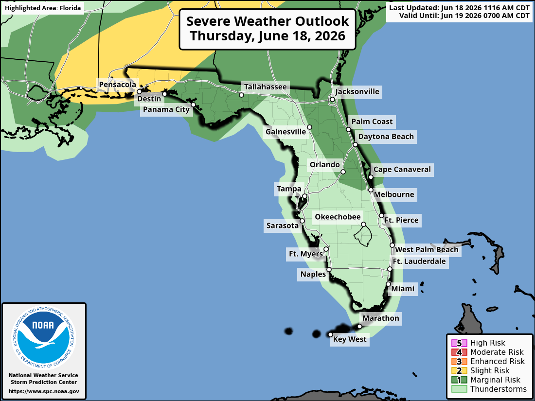
Strong to isolated severe thunderstorms are possible this afternoon and early evening inside the yellow shaded area. General (non-severe) thunderstorms remain possible outside the shaded zone.
The National Weather Service in Jacksonville is alerting residents of the severe storm risk today. The primary threat is damaging wind gusts of 40-60 mph.
Stronger storms may produce:
Timing: Strongest storms expected this afternoon through early this evening. A second round of storms is possible late tonight, especially inland across southeast Georgia.
North Florida and Southeast Georgia areas at highest risk include:
Thursday
Hot and humid with highs in the mid to upper 90s. Heat index values will reach 106°–110°. Strong to isolated severe thunderstorms are likely during the afternoon and evening. Primary threats include damaging winds (40-60 mph), frequent lightning, heavy downpours, and localized flooding. Chance of precipitation 50-70% in the afternoon and evening.
Thursday Night
Scattered showers and thunderstorms, with a chance for a second round of storms late tonight, especially inland across southeast Georgia. Lows in the lower 70s. South wind 5
Copyright 2023-2025 FloridaWord.com

