Severe Thunderstorms, Heat Advisory, Tornado Risk For East Central Florida
Published by
FLORIDA WORD
June 19, 2026 6:39 am
Share
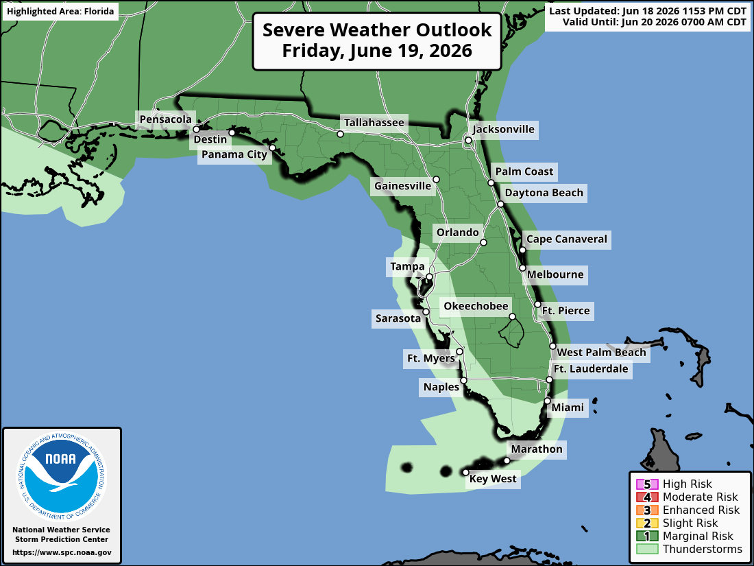
National Weather Service Storm Prediction Center Severe Weather Outlook for Florida for Friday, June 19, 2026.
ORLANDO, Florida – Hot and humid conditions continue across east Central Florida this Friday, June 19, 2026 (Juneteenth).
The National Weather Service in Melbourne forecasts scattered to numerous showers and thunderstorms developing this afternoon and evening. A couple of storms could become strong to severe. A Heat Advisory is in effect from 11 AM to 7 PM for heat indices of 105–111°F.
The National Weather Service Storm Prediction Center issued a Marginal (Level 1) Severe Storm Risk (out of 5) for much of east Central Florida today, including the Orlando metro area, Space Coast, and Treasure Coast.
NWS Melbourne Severe Storm Risk graphic showing a Marginal (Level 1 of 5) risk for severe thunderstorms across East Central Florida on Friday, June 19, 2026 (valid 1PM–11PM).
The NWS warns of the following hazards during the peak storm hours this afternoon and evening:
Frequent lightning strikes
Gusty winds up to 60 mph
Small hail
Low chance of brief spin-ups (funnel clouds or tornadoes)
Locally heavy rainfall (1-2 inches per hour possible in the strongest storms)
A Moderate Rip Current Risk remains in effect for all Atlantic beaches from Daytona through the Treasure Coast. Swim near lifeguards and never enter the surf alone.
East Central Florida cities forecast to see warm temperatures today include:
Orlando (high near 94°F, storms likely afternoon/evening)
Showers and thunderstorms likely, mainly after 2pm. Mostly cloudy, with a high near 94. Southwest wind 5 to 10 mph. Chance of precipitation is 50-70%. Heat index values up to 105-111°F.
Tonight
Showers and thunderstorms likely before midnight, then a slight chance of showers. Partly cloudy, with a low around 76-79. Chance of precipitation is 50-60%.
Saturday
Scattered showers and thunderstorms likely, mainly in the afternoon. Mostly sunny, with a high near 92-94. Chance of precipitation is 50-70%.
Saturday Night
Showers likely and possibly a thunderstorm in the evening. Partly cloudy, with a low around 74-77. Chance of precipitation is 50%.
Sunday
A chance of showers and thunderstorms after 2pm. Mostly sunny, with a high near 92. Chance of precipitation is 40-50%.
Sunday Night
A slight chance of showers. Partly cloudy, with a low around 74-76.