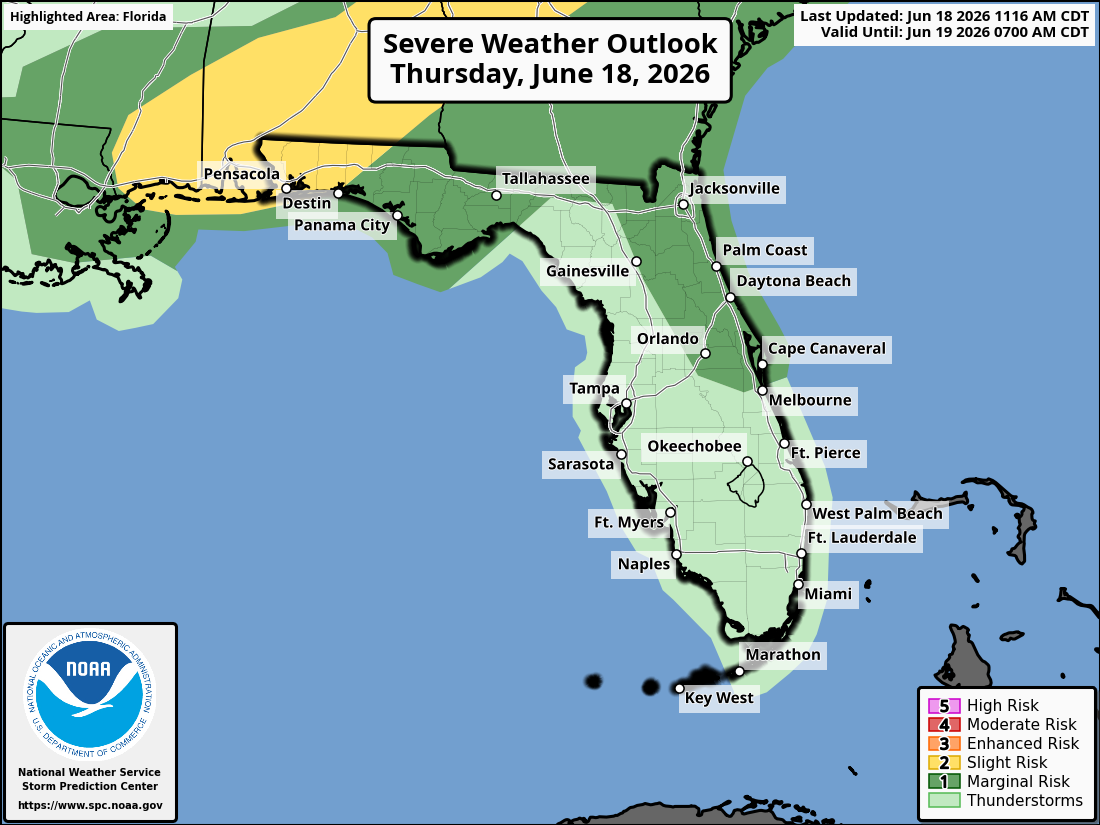
National Weather Service Storm Prediction Center Severe Weather Outlook for Florida for Thursday, June 18, 2026.
ORLANDO, Florida – The National Weather Service in Melbourne reports very hot and muggy conditions across east central Florida on this Thursday, June 18, 2026.
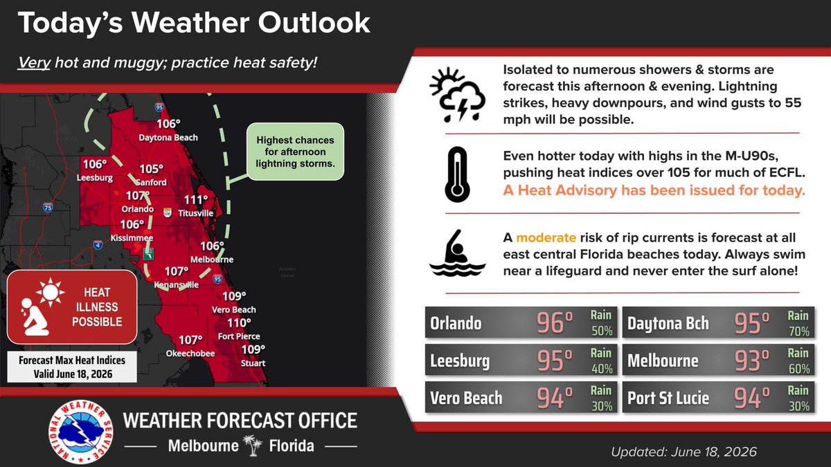
A Heat Advisory is in effect for all of east central Florida from 11 AM to 7 PM today, with highs in the mid to upper 90s and peak heat indices of 105-111°F. Scattered to numerous afternoon and evening showers and thunderstorms are expected areawide.
There is a Marginal risk (Level 1 of 5) for severe storms across portions of east central Florida this afternoon and evening, including areas near Orlando, Daytona Beach, and Cape Canaveral. Primary hazards include isolated damaging wind gusts, frequent lightning, and localized flooding. A brief funnel cloud or waterspout cannot be ruled out.
NWS Melbourne Today’s Weather Outlook Graphic
Slow-moving storms may produce locally heavy rainfall (1-3+ inches in spots), frequent lightning, and isolated damaging wind gusts up to 60 mph. A Moderate Rip Current Risk continues at all east central Florida Atlantic beaches.
The NWS warns of the following hazards during the peak storm hours this afternoon and evening:
Warm and muggy conditions persist with a Major HeatRisk areawide. Residents and visitors should stay well-hydrated, wear light clothing, take frequent breaks in air conditioning or shade, and never leave kids or pets in unattended vehicles.
Heat Exhaustion vs Heat Stroke – Know the Difference
A MODERATE Rip Current Risk is in effect today for ALL Atlantic beaches in the Volusia, Space, and Treasure Coasts. Swim near a lifeguard and follow beach safety instructions.
East Central Florida cities forecast to see hot temperatures today include:
National Weather Service Melbourne Weather Radar (live loop)
Copyright 2023-2025 FloridaWord.com