National Weather Service Miami South Florida Rain Chances - Wednesday, June 3, 2026.
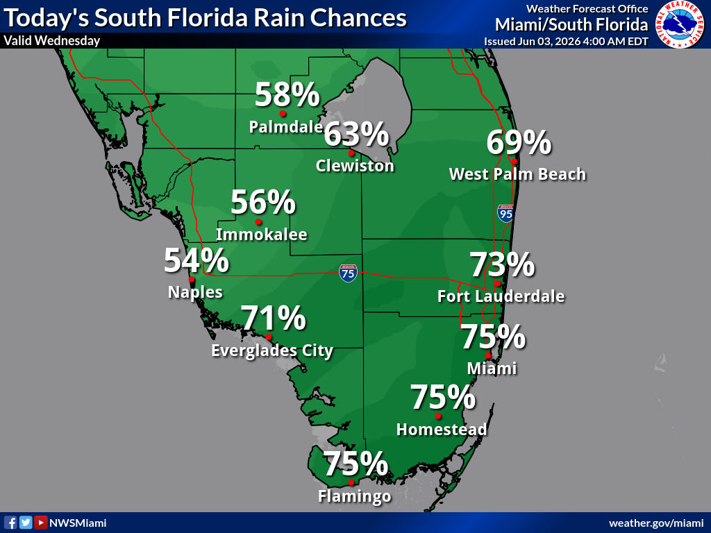
MIAMI, Florida – The National Weather Service in Miami forecasts scattered showers and thunderstorms with high rain chances across much of South Florida today, Wednesday, June 3, 2026, especially impacting the eastern half of the region.
Heavy rainfall, gusty winds, frequent cloud-to-ground lightning, and localized urban flooding remain possible, particularly along the east coast metro corridor from West Palm Beach through Fort Lauderdale to Miami. Slow-moving storms may produce pockets of heavy rain due to abundant moisture and a stalled frontal boundary.
Today’s rain chances (as of the latest NWS probabilistic outlook) are highest across the east coast and southern areas:
Main takeaway from NWS Miami: There is a 90% chance of widespread rainfall totals under 1-2 inches (which may still cause ponding in vulnerable urban and low-lying areas). There is only a 10% chance of isolated higher amounts leading to more significant urban flooding.
Residents in flood-prone areas should monitor conditions closely, avoid driving through flooded roads, and heed any flash flood warnings. Frequent lightning and gusty winds also pose risks with any stronger storms.
Scattered showers and thunderstorms are expected to continue into the evening hours, with rain chances remaining elevated through mid-week as the frontal boundary lingers. Highs today will top out in the mid-80s with muggy conditions.
Copyright 2023-2025 FloridaWord.com
