National Weather Service Storm Prediction Center Severe Weather Outlook for Florida for Thursday, June 18, 2026.
TALLAHASSEE, Florida – The National Weather Service has issued a Flood Watch for today (Thursday) through Friday across southeast Alabama’s Wiregrass region, southwest Georgia, and the Florida Panhandle.
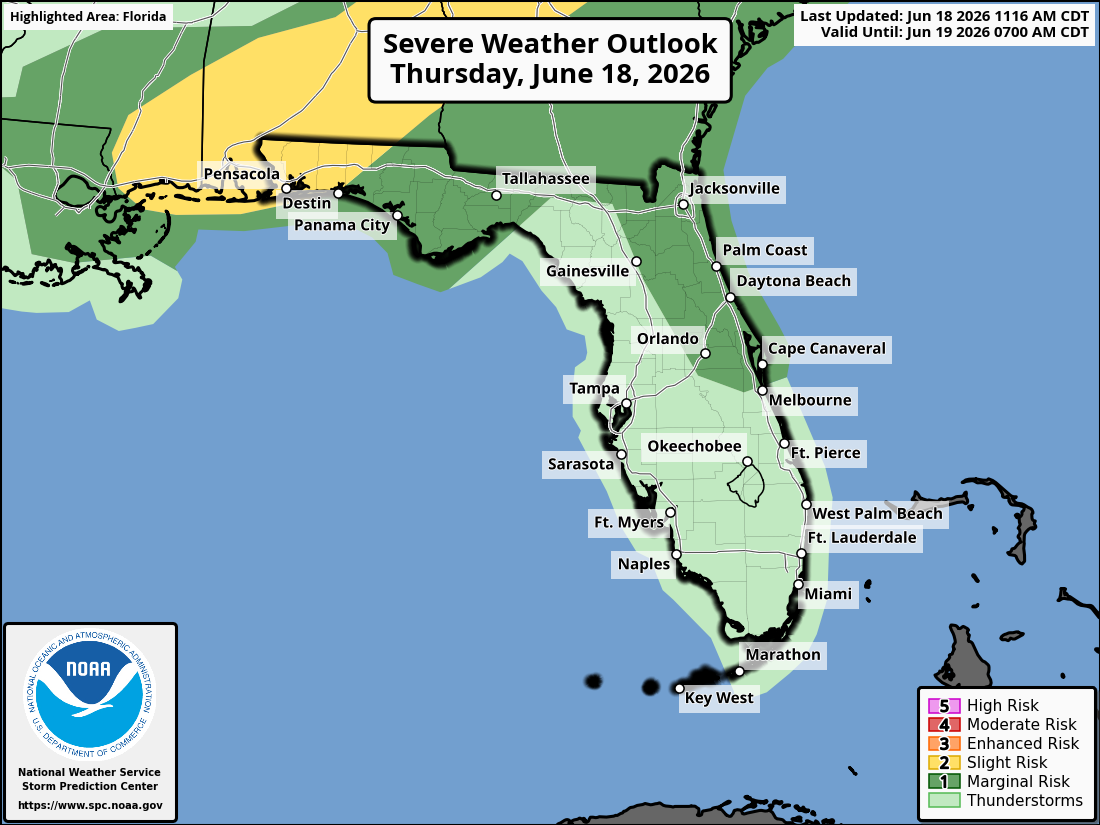
The Storm Prediction Center has placed portions of southeast Alabama and the Florida Panhandle under a Slight Risk (Level 2 of 5) of severe thunderstorms today, with a Marginal Risk (Level 1 of 5) for the remainder of the area.
According to the National Weather Service Tallahassee, the Flood Watch is in effect from Thursday morning through Friday night. Very heavy rain is expected, with most areas receiving 3–7 inches and isolated high-end totals of 8–12 inches possible. Dangerous and life-threatening flash flooding is possible where the heaviest rain falls.
The main hazards with any stronger storms are isolated to scattered damaging wind gusts up to 60 mph, heavy rainfall capable of producing flash flooding, and frequent dangerous lightning.
Cities at risk for thunderstorms, heavy rain, and possible strong to severe weather include:
Copyright 2023-2025 FloridaWord.com


