National Weather Service Tampa Bay Forecast for West Central and Southwest Florida on Saturday, May 16, 2026.
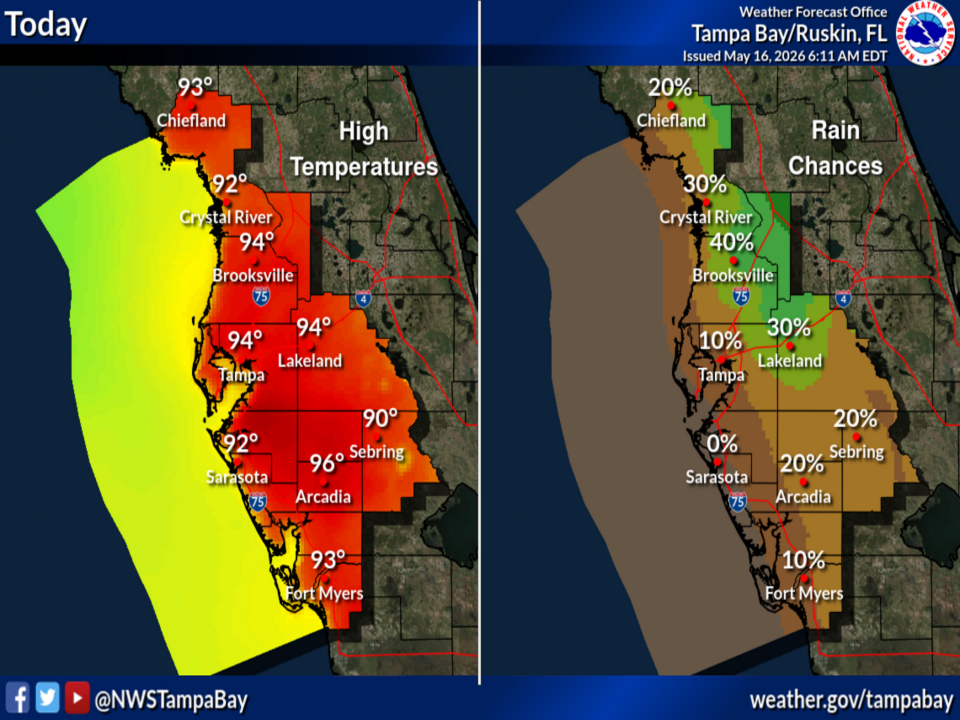
TAMPA BAY, Florida – The National Weather Service Tampa Bay forecasts hot and mostly dry conditions today, Saturday, May 16, 2026, with high temperatures climbing into the low-to-mid 90s across west central and southwest Florida. Rain chances remain low (generally 0-40%) with the best chance of any isolated afternoon activity over the northern counties.
Moisture will increase noticeably on Sunday, bringing scattered to numerous showers and thunderstorms, especially across the southern and interior portions of the region.
The National Weather Service (NWS) Tampa Bay has issued updated forecast maps showing persistently warm conditions today with limited rain chances, followed by a noticeable increase in shower and thunderstorm activity on Sunday.
The potential hazards include lightning and locally heavy rainfall, especially on Sunday.
The forecast covers areas such as Tampa, St. Petersburg, Sarasota, Fort Myers, and northward toward the Nature Coast. Highest temperatures today will be in the interior; rain chances rise sharply on Sunday, particularly over southern and eastern counties.
Showers and thunderstorms remain isolated to scattered today but become more widespread on Sunday during the afternoon and evening hours.
Copyright 2023-2025 FloridaWord.com


