Thunderstorms, Rain For Tampa Bay, Southwest Florida
Published by
FLORIDA WORD
May 13, 2026 4:29 am
Share
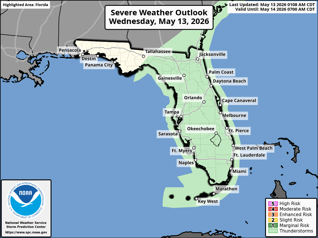
National Weather Service Storm Prediction Center Severe Weather Outlook for Florida on Wednesday, May 13, 2026.
TAMPA BAY, Florida – The National Weather Service Tampa Bay forecasts isolated to scattered showers and a few thunderstorms shifting onshore from the Gulf on Wednesday, May 13, 2026, with the highest rain chances expected over the interior this afternoon.
Drier air will fill in tonight and persist through the rest of the week.
The National Weather Service (NWS) Tampa Bay has issued a weather outlook for Wednesday, May 13, 2026, calling for isolated to scattered showers and thunderstorms across the Tampa Bay region and west Central Florida.
The potential hazards include lightning and heavy rainfall.
The forecast covers areas such as Tampa, St. Petersburg, Sarasota, and northward toward the Nature Coast. Highest rain chances across the interior.
Showers and thunderstorms are expected during the afternoon hours. Isolated to scattered activity will shift onshore from the Gulf this afternoon into the evening.
National Weather Service Tampa Radar for West Central Florida and Southwest Florida.
Tampa Weather Forecast
Today
A slight chance of showers before noon, then a slight chance of showers and thunderstorms between noon and 3pm. Mostly sunny, with a high near 88. Light and variable wind becoming west southwest 5 to 10 mph in the morning. Chance of precipitation is 20%.
Tonight
Partly cloudy, with a low around 72. West northwest wind 3 to 7 mph.
Thursday
Sunny, with a high near 89. Light north wind becoming northwest 5 to 10 mph in the morning.
Thursday Night
Mostly clear, with a low around 70. Northwest wind 3 to 8 mph.
Friday
Sunny, with a high near 92. Light and variable wind becoming west around 6 mph in the afternoon.
Friday Night
Mostly clear, with a low around 72. North northwest wind 5 to 7 mph becoming light and variable.
Saturday
A 20 percent chance of showers and thunderstorms after 2pm. Sunny, with a high near 94. East southeast wind 5 to 8 mph becoming south southwest in the afternoon.
Saturday Night
A 10 percent chance of showers and thunderstorms before 8pm. Partly cloudy, with a low around 74. West wind around 6 mph becoming east after midnight.
Sunday
A 40 percent chance of showers and thunderstorms after 2pm. Mostly sunny, with a high near 93. East southeast wind around 6 mph becoming south southwest in the afternoon.
Sunday Night
A 30 percent chance of showers and thunderstorms, mainly before 8pm. Partly cloudy, with a low around 74.