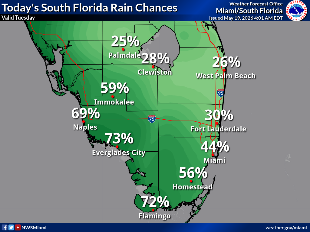
National Weather Service Miami South Florida Rain Chances Tuesday, May 19, 2026.
MIAMI, Florida – The National Weather Service in Miami/South Florida is forecasting scattered showers and isolated thunderstorms across portions of South Florida on Tuesday, May 19, 2026.
According to the latest South Florida Rain Chances map, probability of precipitation is highest across southwest Florida: 73% Everglades City, 72% Flamingo, 69% Naples, 59% Immokalee, 56% Homestead, 44% Miami, 30% Fort Lauderdale, 28% Clewiston, 26% West Palm Beach, and 25% Palmdale.
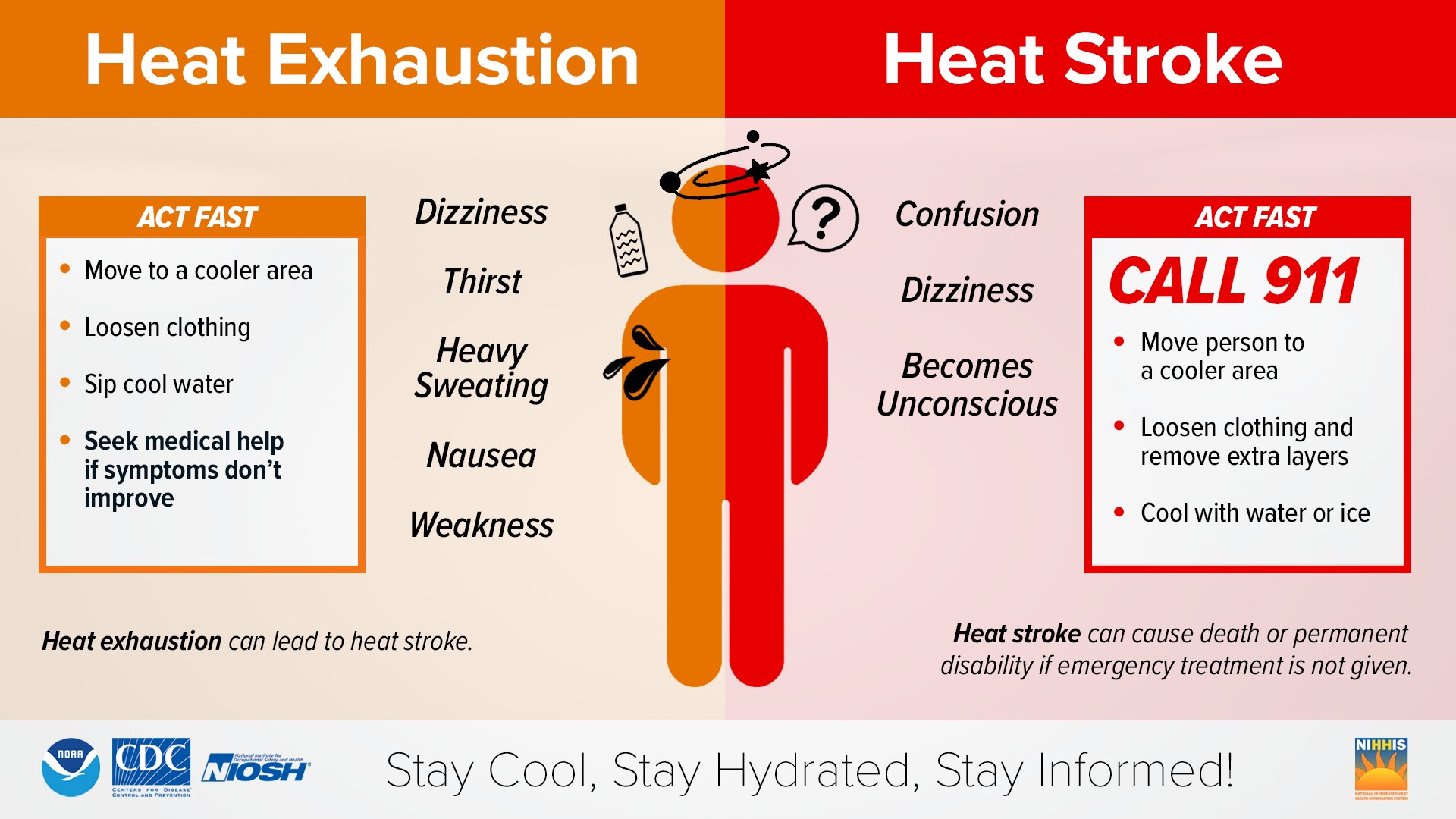
Dangerously high heat indices are forecast this afternoon across much of South Florida. Values will peak as high as 103°F in Naples, 102°F in Everglades City, 101°F in Immokalee, 98°F in Buckhead Ridge, 97°F in La Belle, and 94–96°F across the eastern counties. Residents should take extra precautions against heat-related illnesses.
Take action when you see symptoms of heat exhaustion and heat stroke. To reduce risk during outdoor work, the Occupational Safety and Health Administration recommends scheduling frequent rest breaks in shaded or air-conditioned environments.
Copyright 2023-2025 FloridaWord.com