National Weather Service Storm Prediction Center Severe Weather Outlook for Florida on Sunday, May 17, 2026.
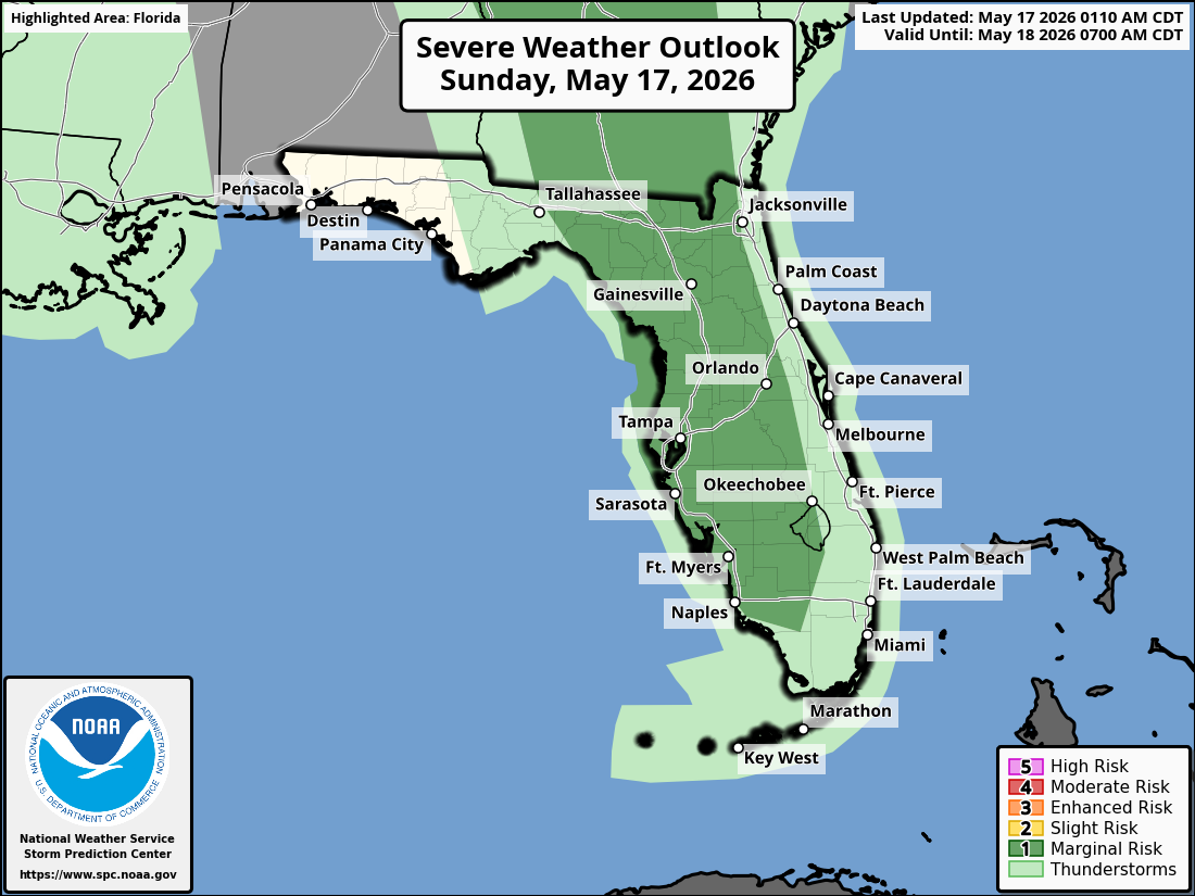
TALLAHASSEE, Florida – A Marginal Risk of severe thunderstorms is expected to impact the eastern Florida Big Bend and southwest Georgia this afternoon and early evening, according to the National Weather Service in Tallahassee.
The Storm Prediction Center has issued a Marginal Risk (Level 1 of 5) of severe thunderstorms for the eastern Florida Big Bend and southwest Georgia, mainly along and east of I-75 this afternoon. A general thunderstorm risk exists across the broader tri-state area, with the highest coverage along and south of the I-10 corridor.
Scattered showers and thunderstorms are possible this morning through early evening across the entire Tri-State region. Stronger storms are possible this afternoon and early evening.
Primary hazards with any stronger storms today include isolated damaging wind gusts, small hail, and locally heavy rainfall. Dangerous lightning, torrential downpours, and isolated flash flooding are also possible where storms train over the same areas. Lightning remains a concern with all thunderstorms. Patchy fog is possible early this morning in portions of southeast Alabama, southwest Georgia, and the Florida Panhandle.
On a positive note, beneficial rainfall is expected region-wide and will continue through the week. This will help alleviate ongoing dry conditions across the area.
Cities at risk for thunderstorms today include:
High temperatures across the Florida Panhandle and north Florida will be in the low 90s °F. Overnight lows will drop into the low 70s.
Copyright 2023-2025 FloridaWord.com


