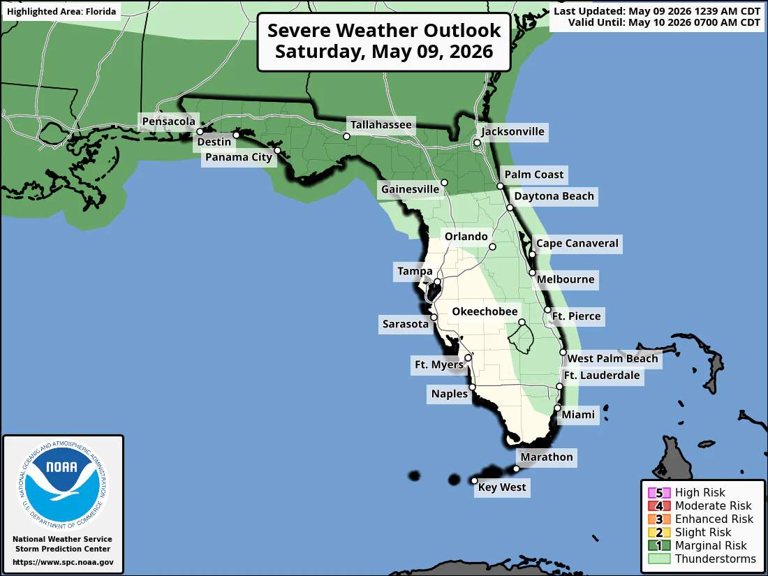
National Weather Service Storm Prediction Center Severe Weather Outlook for Florida on Saturday, May 9, 2026.
JACKSONVILLE, Florida – The National Weather Service in Jacksonville is forecasting isolated strong thunderstorms this afternoon and early evening along the I-10 corridor from northeast Florida north to Waycross, Georgia, driven by a stationary front near the FL/GA line.
Isolated strong thunderstorms are expected mainly this afternoon and early evening (2 PM to 8 PM), particularly inland along and north of I-10 in northeast Florida into southeast Georgia.
The National Weather Service in Jacksonville is alerting residents of the storm risk today. The primary threat is damaging wind gusts of 40-60 mph.
According to NWS Jacksonville, stronger storms may develop with scattered showers and isolated strong to severe thunderstorms possible across inland northeast Florida into southeast Georgia, mainly along and north of I-10.
Stronger storms on Saturday may produce:
Ongoing extreme to exceptional drought conditions continue across the region. The storms are expected to bring widespread beneficial rainfall, providing needed moisture amid the drought. Residents should practice wildfire prevention measures given the dry conditions and ongoing fire activity.
North Florida and Southeast Georgia areas at highest risk for thunderstorms include:
Saturday
Mostly cloudy with a high near 85°F. South winds 5-15 mph. Scattered showers and thunderstorms likely in the afternoon and evening, especially inland along and north of I-10. Chance of precipitation 50-70%. Hazards include damaging winds (40-60 mph), frequent lightning, locally heavy downpours, and small hail.
Saturday Night
Chance of showers and thunderstorms, mainly before midnight. Low around 68°F. South wind 5-10 mph becoming light.
Copyright 2023-2025 FloridaWord.com


