National Weather Service Storm Prediction Center Severe Weather Outlook for Florida on Saturday, May 2, 2026.
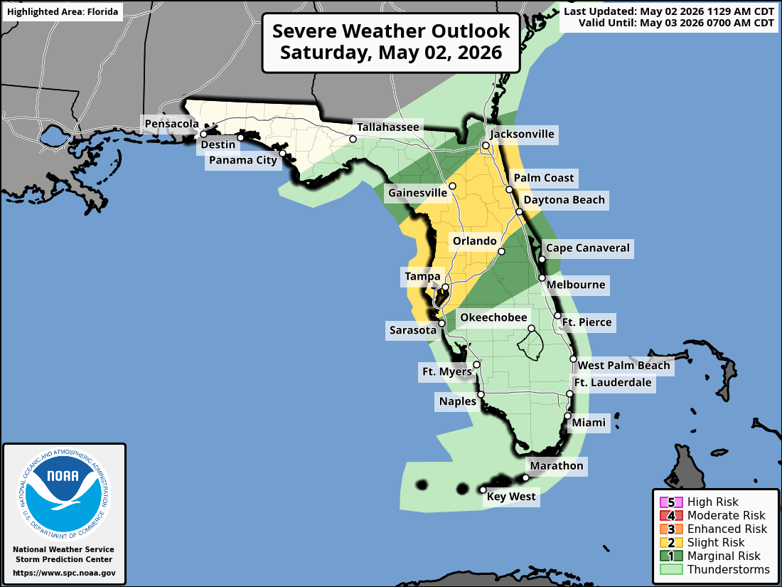
ORLANDO, Florida – The National Weather Service Storm Prediction Center has issued a Severe Weather Outlook for Saturday, May 2, 2026, with a Slight Risk of severe thunderstorms across portions of east central Florida (particularly northern Lake and Volusia counties) and a Marginal Risk farther south.
Hot and windy conditions are forecast for today with near-record highs in the low to mid 90s (especially near the southern coast).
A Wind Advisory is in effect for many counties with gusts of 30-35 mph. Scattered showers and thunderstorms will develop this afternoon across portions of the Florida Peninsula and become more numerous in the evening ahead of a cold front. A few storms may become strong to severe.
The NWS warns of the following hazards during the peak storm hours this afternoon and evening on Saturday:
A Red Flag Warning is also in effect for portions of the area due to critical fire weather conditions this afternoon.
East Central Florida cities forecast to see very warm temperatures today include:
Today (Saturday)
Hot and windy. High near 93°F. Chance of showers and thunderstorms increasing in the afternoon. Southwest winds 15-20 mph with gusts to 35 mph.
Tonight
Showers and thunderstorms likely. Low around 68°F.
Copyright 2023-2025 FloridaWord.com


